File:M0780 atlas 1874.jpg: Difference between revisions
No edit summary |
No edit summary |
||
| Line 1: | Line 1: | ||
{{Image | |||
|File name=M0780 atlas 1874.jpg | |||
|Mine-index=0780 | |||
|Coal_co=Turkey Hill Mining Company | |||
|Mine_name=Turkey Hill Mine | |||
|Map Date=1874 | |||
|Map Type=Atlas | |||
|Map Scale=1:62500 | |||
|Map Status=Secondary source | |||
|county1=St. Clair | |||
|quad1=Freeburg | |||
|Image Notes=Warner & Beers, 1874, An Illustrated Historical Atlas of St. Clair County, IL, Warner & Beers Publishers, Chicago, Illinois, 115p. | |||
|Image Used For=years of operation | |||
}} | |||
Latest revision as of 10:39, October 4, 2021
| Mine Index(s): | 0780 |
| Mine Company: | Turkey Hill Mining Company |
| Mine Name | Turkey Hill Mine |
| Map Date | 1874 |
| Map Scale | 1:62500 |
| Map Type microfilm/company/wpa/quade | Atlas |
| Map Status final,not final, secondary | Secondary source |
| ID Number | |
| Used For | years of operation |
| Notes | Warner & Beers, 1874, An Illustrated Historical Atlas of St. Clair County, IL, Warner & Beers Publishers, Chicago, Illinois, 115p. |
| Image Credit | |
File history
Click on a date/time to view the file as it appeared at that time.
| Date/Time | Thumbnail | Dimensions | User | Comment | |
|---|---|---|---|---|---|
| current | 10:37, October 4, 2021 | 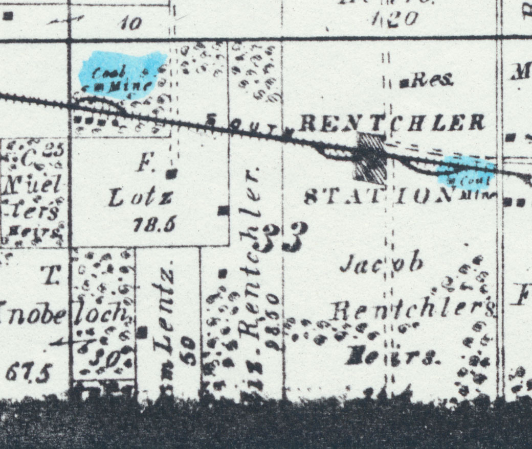 | 1,040 × 879 (216 KB) | Cheri (talk | contribs) |
You cannot overwrite this file.
File usage
The following page uses this file: