Mine Index Number: 0780
| Company Name:
|
J. W. Moser
|
| Mine Name:
|
Turkey Hill Mine
|
| Start Date:
|
1887
|
End Date:
|
1900
|
| Type of Mine:
|
Underground
|
| Total acres shown:
|
25
|
| Acres after map date:
|
27
|
General Area of mining acres shown:
|
|
|
|
Shaft, Slope, Drift or Tipple Location(s)
| Type
|
County
|
Township-Range
|
Section
|
Part Section
|
| Main shaft
|
St. Clair
|
1N 7W
|
33
|
SW NW NW
|
| Air shaft
|
St. Clair
|
1N 7W
|
33
|
SE NW NW
|
Geology
| Herrin
|
103
|
|
|
6.0
|
MRP. some RPB
|
Geological Problems Reported
Production
| Company
|
Mine Name
|
Date
|
Production (tons)
|
| Turkey Hill Mining Company
|
Turkey Hill
|
1887-1887
|
41,000 The reported production accounts for only 5 of the 25 acres shown on the accompanying map. Mining occurred under a previous owner who is unknown (see Mines Whose Locations Are Not Known, mines near Rentchler). The 1874 Atlas of St. Clair County showed a mine at this location, indicating that mining may have occurred 13 years prior to this recorded history.
|
|
|
|
|
|
|
|
| Total Production: 303,404
|
Production Notes
Coal Report production (if available)
Sources of Data
| Microfilm, document 351046
|
12-16-1887
|
1:1200
|
1:2069
|
Not final
|
Annotated Bibliography (Data source - brief description of information)
| Coal Reports - Production, ownership, years of operation.
|
| Directory of Illinois Coal Mines (St. Clair County) - Mine names, mine index, ownership, years of operation.
|
| Mine notes (St. Clair County) - Mine type, shaft location, seam, depth, thickness.
|
| Microfilm map, document 351046, reel 03134, frame 141 - Shaft locations, mine outline, mining method.
|
Mine Notes
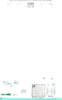
Mine Images
Atlas:
Map Date: 1874
Coal Co.: Turkey Hill Mining Company
Mine Name: Turkey Hill Mine
Microfilm: 351046
Map Date: 12-16-1887
Coal Co.: Turkey Hill Mining Company
Mine Name: Turkey Hill Mine
Full Res Download
Photographs