File:M0304 atlas1874.jpg: Difference between revisions
No edit summary |
Alan.Myers (talk | contribs) No edit summary |
||
| Line 9: | Line 9: | ||
|Map Scale=1:62500 | |Map Scale=1:62500 | ||
|Map Status=Secondary source | |Map Status=Secondary source | ||
|Map hires=https://wikiimage.isgs.illinois.edu/ilmines/st_clair/m0304_atlas1874_geo.zip | |||
|county1=St. Clair | |county1=St. Clair | ||
|quad1=Lebanon | |quad1=Lebanon | ||
Latest revision as of 10:55, January 18, 2022
CLICK HERE TO DOWNLOAD THE HIGH RESOLUTION IMAGE. FILE SIZE MAY BE LARGE(Note:this file is usually better quality than "original file" linked above)
| Mine Index(s): | 0304, 3595,3595 |
| Mine Company: | Jeremiah Bennett |
| Mine Name | Bennett Mine |
| Map Date | 1874 |
| Map Scale | 1:62500 |
| Map Type microfilm/company/wpa/quade | Atlas |
| Map Status final,not final, secondary | Secondary source |
| ID Number | |
| Used For | years of operation, mine locations |
| Notes | Warner & Beers, 1874, An Illustrated Historical Atlas of St. Clair County, IL, Warner & Beers Publishers, Chicago, Illinois, 115p. |
| Image Credit | |
| Hi-Res Download | Click to download |
File history
Click on a date/time to view the file as it appeared at that time.
| Date/Time | Thumbnail | Dimensions | User | Comment | |
|---|---|---|---|---|---|
| current | 17:19, August 27, 2021 | 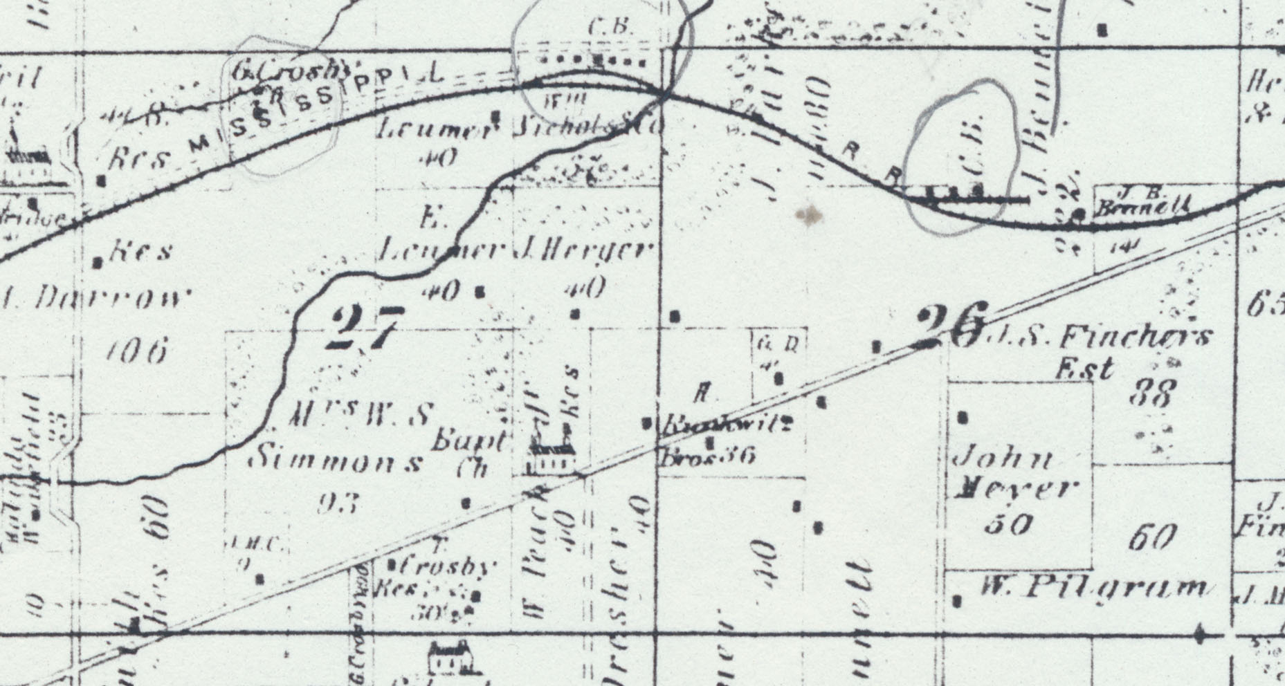 | 1,857 × 992 (276 KB) | Cheri (talk | contribs) |
You cannot overwrite this file.