Mine Index Number: 0304
| Company Name:
|
International Coal and Mining Company
|
| Mine Name:
|
Bennett Mine
|
| Start Date:
|
Pre 1874
|
End Date:
|
1912
|
| Type of Mine:
|
Underground
|
| Total acres shown:
|
27
|
| Production Indicated Acres:
|
159
|
General Area of mining acres shown:
|
|
|
|
Shaft, Slope, Drift or Tipple Location(s)
| Type
|
County
|
Township-Range
|
Section
|
Part Section
|
| Main shaft
|
St. Clair
|
2N 7W
|
26
|
NW SW NE
|
| Air shaft
|
St. Clair
|
2N 7W
|
26
|
SW NW NE
|
Geology
| Herrin
|
183-200
|
|
|
5.0-7.0
|
RPB
|
Geological Problems Reported
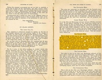
A 1907 report in the mine notes indicated that the old works were closed “and said to be mostly caved”. The source map indicated the roof was down in the west part of the mine. The top 4 inches of coal were always left to support the shale roof. The Coal Report of 1884 indicates there was some gas in the workings, but improved ventilation corrected that condition.
Production
| Company
|
Mine Name
|
Date
|
Production (tons)
|
| Jeremiah Bennett
|
Bennett
|
pre1874-1886 Idle 1886
|
42,090 Production and ownership prior to 1882 unknown. The Coal Report of 1883 indicates 20 acres were mined.
|
|
|
|
|
|
|
|
| Total Production: 1,002,299
|
Production Notes
Coal Report production (if available)
Sources of Data
| Microfilm, document 351060
|
undated
|
1:960
|
1:1721
|
Undated
|
Annotated Bibliography (Data source - brief description of information)
| Coal Reports - Production, ownership, years of operation, thickness, depth, seam, geologic problems.
|
| Directory of Illinois Coal Mines (St. Clair County) - Mine names, mine index, ownership, years of operation.
|
| Mine notes (St. Clair County) - Mine type, shaft location, seam, depth, thickness, geologic problems.
|
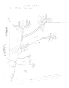
| Microfilm, document 351060, reel 03134, frame 158 - Mine outline, shaft locations, mining method, geologic problems.
|
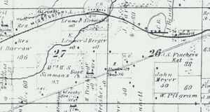
| Atlas of St. Clair County, 1874, Warner and Beers, Chicago, Illinois - Shaft location, years of operation.
|
Mine Notes
Mine Images
Atlas:
Map Date: 1874
Coal Co.: Jeremiah Bennett
Mine Name: Bennett Mine
Full Res Download
Microfilm: 351060
Map Date: Undated
Coal Co.: International Coal and Mining Company
Mine Name: Bennett Mine
Full Res Download
Photographs


