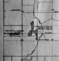
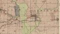
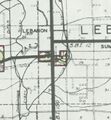
Lebanon Quadrangle
Mining in the Lebanon Quadrangle
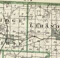
Mining in this quadrangle began prior to 1874, and continued until 1956. The date of the earliest mining is not known; the 1874 Atlas of St. Clair County shows the Bennett Mine (mine index 304) shaft location west of Lebanon. The most recent mine is the Schubert Mine (mine index 3486), extending north into the Lebanon quadrangle from Mascoutah. This mine also operated the longest, over 74 years.
The Herrin Coal was the only coal mined here, ranging from 4.0 to 9.0 feet thick and 115 to 285 feet deep. Most of the mines reported poor roof or difficulties with the roof. The mines extending into the Lebanon quadrangle from Mascoutah were the exceptions, which had limestone over much of their workings. The Lebanon mines were small and short-lived, probably due to geologic problems. Slips made the roof unstable, as well as allowing gas and water to seep into the mine. The gray shale roof required more support, which raised the cost of mining.
Map and Directory PDF Download
Coal Mines In Illinois Lebanon Quadrangle
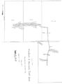
Mines that Appear on the Lebanon Quadrangle
Unlocated Mines
St. Clair County
Pages in category "Lebanon Quadrangle"
The following 12 pages are in this category, out of 12 total.
Media in category "Lebanon Quadrangle"
The following 22 files are in this category, out of 22 total.
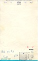
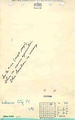 M0200 minenotes.pdf 737 × 1,183, 15 pages; 3.15 MB
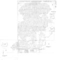
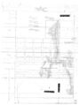 M0200mrg.jpg 2,526 × 3,390; 894 KB
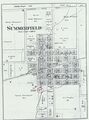
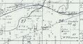 M0304 atlas1874.jpg 1,857 × 992; 276 KB
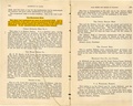
 M0304 coalreport1884 p569.pdf 1,589 × 1,247; 374 KB
 M0304 minenotes.pdf 737 × 1,183, 6 pages; 1.19 MB
 M0304.jpg 2,658 × 3,390; 434 KB
 M0340.jpg 1,925 × 3,390; 1.33 MB
 M1630149 coalreport1897 p120.pdf 839 × 1,185; 206 KB
 M3485 minenotes.pdf 737 × 1,183, 18 pages; 5.33 MB
 M3486 coalreport1884.pdf 1,587 × 1,272; 333 KB
 M3486mrg.jpg 3,218 × 3,390; 1.48 MB
 M3593 atlas1874.jpg 3,501 × 4,726; 2.04 MB
 M3593 coalreport1884 p569.pdf 1,589 × 1,247; 371 KB
 M3593 minenotes.pdf 737 × 1,183, 3 pages; 618 KB
 M3594 351065.jpg 3,008 × 3,390; 829 KB
 M3594 coalreport1884 p569.pdf 1,589 × 1,247; 372 KB
 M3594 maswpa.jpg 686 × 701; 122 KB
 M3595 351012.jpg 2,524 × 3,390; 331 KB
 M3595 atlas1876.jpg 443 × 427; 115 KB
 M3595 coalreport1884.pdf 1,589 × 1,247; 373 KB
 M4270 GFolio195.jpg 764 × 432; 599 KB
 M4271 quade.jpg 612 × 660; 99 KB


