Category:Equality-Quadrangle: Difference between revisions
Alan.Myers (talk | contribs) (Created page with "{{County-Page}}") |
Alan.Myers (talk | contribs) No edit summary |
||
| Line 1: | Line 1: | ||
{{County- | __NOTOC__ | ||
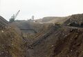
==Mining in the Equality Quadrangle== | |||
Mining in this area generally took place after 1890, with small underground mines in the Springfield Coal. | |||
A few underground mines operated in the Herrin and Davis Coals, but these coals are thinner, ranging up | |||
to just over 4 feet thick. Surface mining began in 1945. Thinner coals, such as the Dekoven (about 3 feet | |||
thick) and the Briar Hill (generally around 2.5 feet thick) Coals were taken as the large mines targeted the | |||
Herrin, Springfield and Davis Coals. | |||
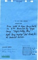
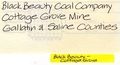
The West Side Mine of Gallatin Coal & Coke Company ([[0047|mine index 47]]) flooded on April 6, 1913. This | |||
event received a substantial write-up in the 1913 Coal Report, which indicated that the citizens of Equality | |||
helped unstintingly in trying to construct levees around the mine shaft so that the mine would not be | |||
inundated by the record-breaking floods of that year. Heavy timber retaining walls and trenches to route | |||
water away from the mine were constructed in late March, but by April 1, the mine was surrounded by | |||
water and materials had to be brought in by boat. The currents under the water eroded the soil under the | |||
levees and the water broke into the shaft, rushing with such power as to wash pit cars and other | |||
machinery into the rapidly filling shaft. Since the extremities of the mine away from the shaft were at lower | |||
elevations, large bubbles of compressed air remained after the shaft was filled with water. Water | |||
continued to run in for five hours after the shaft was filled, further compressing the air in the mine, so that | |||
when the air rebounded that afternoon, the force of the “explosion” threw pit cars, engines, cages and | |||
concrete blocks to an estimated height of 500 feet, utterly destroying the top works of the mine. A second | |||
outburst of air occurred less than half an hour later, throwing water a height of approximately 150 feet. | |||
Each subsequent outburst was less extreme than the previous one, until all the air was out of the mine. | |||
Construction of a new shaft was begun in November 1913, but production was delayed until late 1915. | |||
Portions of this quadrangle are within the Eagle Valley Syncline. The geology of the area is very complex, | |||
with many fault zones, including the Shawneetown Fault Zone, Cottage Grove Fault System, and | |||
Grindstaff Fault Zone. These structures are beyond the scope of this introduction, but more information | |||
can be found in the Geologic map of Equality Quadrangle, Gallatin and Saline Counties, Illinois ([http://library.isgs.illinois.edu/Maps/pdfs/igq/igq02-equality.pdf ISGSIGQ002]) and Structural Geology of Southeastern Illinois and Vicinity (ISGS Circular 538). | |||
==Map and Directory PDF Download== | |||
[https://wikiimage.isgs.illinois.edu/ilmines/webfiles/topo-mines/equality.pdf Coal Mines In Illinois Equality Quadrangle]</br> | |||
==Mines that Appear on the Equality Quadrangle== | |||
{{#css: | |||
#mw-subcategories {display: none} | |||
#mw-pages {display: none} | |||
#mw-category-media {display: none} | |||
}} | |||
{{#ask:[[Category:Equality-Quadrangle]] | |||
[[:+]] | |||
[[Unlocated::No]] | |||
|?combined = Coal Company, Mine Name | |||
|?County | |||
|format=datatable|limit=500|link=all|sort=Mine Index|order=asc|headers=plain|mainlabel=Mine Index|searchlabel=... further results|class=sortable wikitable smwtable|sep=<br>|Default='''Mines for this quadrangle have not been entered into Ilmines-Wiki see download above for more information'''}} | |||
==Unlocated Mines== | |||
===Saline County=== | |||
{{#ask:[[Category:Saline-County]] | |||
[[:+]] | |||
[[Unlocated::Yes]] | |||
|?combined = Coal Company, Mine Name | |||
|?City | |||
|format=datatable|limit=500|link=all|sort=Mine Index|order=asc|headers=plain|mainlabel=Mine Index|searchlabel=... further results|default=There are no known Unlocated mines in this county |class=sortable wikitable smwtable|sep=<br>}} | |||
{{DISPLAYTITLE:Equality Quadrangle}} | |||
Revision as of 12:46, February 18, 2022
Mining in the Equality Quadrangle
Mining in this area generally took place after 1890, with small underground mines in the Springfield Coal. A few underground mines operated in the Herrin and Davis Coals, but these coals are thinner, ranging up to just over 4 feet thick. Surface mining began in 1945. Thinner coals, such as the Dekoven (about 3 feet thick) and the Briar Hill (generally around 2.5 feet thick) Coals were taken as the large mines targeted the Herrin, Springfield and Davis Coals.
The West Side Mine of Gallatin Coal & Coke Company (mine index 47) flooded on April 6, 1913. This event received a substantial write-up in the 1913 Coal Report, which indicated that the citizens of Equality helped unstintingly in trying to construct levees around the mine shaft so that the mine would not be inundated by the record-breaking floods of that year. Heavy timber retaining walls and trenches to route water away from the mine were constructed in late March, but by April 1, the mine was surrounded by water and materials had to be brought in by boat. The currents under the water eroded the soil under the levees and the water broke into the shaft, rushing with such power as to wash pit cars and other machinery into the rapidly filling shaft. Since the extremities of the mine away from the shaft were at lower elevations, large bubbles of compressed air remained after the shaft was filled with water. Water continued to run in for five hours after the shaft was filled, further compressing the air in the mine, so that when the air rebounded that afternoon, the force of the “explosion” threw pit cars, engines, cages and concrete blocks to an estimated height of 500 feet, utterly destroying the top works of the mine. A second outburst of air occurred less than half an hour later, throwing water a height of approximately 150 feet. Each subsequent outburst was less extreme than the previous one, until all the air was out of the mine. Construction of a new shaft was begun in November 1913, but production was delayed until late 1915.
Portions of this quadrangle are within the Eagle Valley Syncline. The geology of the area is very complex, with many fault zones, including the Shawneetown Fault Zone, Cottage Grove Fault System, and Grindstaff Fault Zone. These structures are beyond the scope of this introduction, but more information can be found in the Geologic map of Equality Quadrangle, Gallatin and Saline Counties, Illinois (ISGSIGQ002) and Structural Geology of Southeastern Illinois and Vicinity (ISGS Circular 538).
Map and Directory PDF Download
Coal Mines In Illinois Equality Quadrangle
Mines that Appear on the Equality Quadrangle
Unlocated Mines
Saline County
Pages in category "Equality-Quadrangle"
The following 107 pages are in this category, out of 107 total.
0
2
3
4
Media in category "Equality-Quadrangle"
The following 5 files are in this category, out of 5 total.
 M0995 minenotes.pdf 752 × 1,177, 23 pages; 4.21 MB
 M1004 minenotes.pdf 750 × 1,250, 17 pages; 3.39 MB
 M1022 minenotes.pdf 737 × 1,175, 20 pages; 4.3 MB
 M1044 minenotes.pdf 560 × 302, 11 pages; 4.43 MB
 Mn act gallatin 01.jpg 2,956 × 2,056; 528 KB
