3545: Difference between revisions
No edit summary |
No edit summary |
||
| Line 1: | Line 1: | ||
{{Sidebar Info Query}} | {{Sidebar Info Query}} | ||
{{Header | {{Header | ||
|checked= | |checked=Checked OK | ||
|unlocated=No | |unlocated=No | ||
|shown_on_map=Yes | |shown_on_map=Yes | ||
| Line 9: | Line 9: | ||
|mine_type=Underground | |mine_type=Underground | ||
|mined-out-area=11 | |mined-out-area=11 | ||
|indicated=No | |||
|county1=St. Clair | |county1=St. Clair | ||
|quad1=French Village | |quad1=French Village | ||
Revision as of 13:54, September 24, 2022
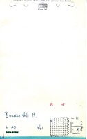
Mine Index Number: 3545
| Company Name: | Bunker Hill Mine | ||
|---|---|---|---|
| Mine Name: | Bunker Hill Mine | ||
| Start Date: | 1932 | End Date: | 1939 |
| Type of Mine: | Underground | ||
| Total acres shown: | 11 | ||
| Acres after map date: | General Area of mining acres shown: | ||
Shaft, Slope, Drift or Tipple Location(s)
| Type | County | Township-Range | Section | Part Section |
|---|
| Main drift | St. Clair | 1N 9W | 11 | SW NW NW |
| Air shaft | St. Clair | 1N 9W | 11 | SW NW NW |
Geology
| Thickness (ft) | |||||
|---|---|---|---|---|---|
| Seam | Depth (ft) | Min | Max | Ave | Mining Method |
| Herrin | RPB |
Geological Problems Reported
Production
| Company | Mine Name | Date | Production (tons) |
| William Travis | Travis | 1932-1939 | 63,643 |
| Bunker Hill Mine | Bunker Hill | 1939-1939 | 4,076 |
| Total Production: 67,719 | |||
Production Notes
Coal Report production (if available)
Sources of Data
| Source Map | Map Date | Original Scale | Digitized Scale | Map Type |
| Microfilm, document 351064 | 11-13-1939 | 1:1200 | 1:1407 | Final |
Annotated Bibliography (Data source - brief description of information)
| Coal Reports - Production, ownership, years of operation. |
| Directory of Illinois Coal Mines (St. Clair County) - Mine names, mine index, ownership, years of operation. |
| Microfilm map, document 351064, reel 03134, frame 162 - Drift location, mine outline, method. |
| Mine notes (St. Clair County) - Seam, mine type, drift location. |
Mine Notes
Mine Images

Photographs