0285: Difference between revisions
No edit summary |
No edit summary |
||
| Line 1: | Line 1: | ||
{{Sidebar Info Query}} | {{Sidebar Info Query}} | ||
{{Header | {{Header | ||
|checked= | |checked=Checked OK | ||
|unlocated=No | |unlocated=No | ||
|shown_on_map=Yes | |shown_on_map=Yes | ||
| Line 9: | Line 9: | ||
|mine_type=Underground | |mine_type=Underground | ||
|mined-out-area=651 | |mined-out-area=651 | ||
|indicated=No | |||
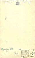
|county1=Madison | |county1=Madison | ||
|quad1=Edwardsville | |quad1=Edwardsville | ||
| Line 104: | Line 105: | ||
}} | }} | ||
{{Annotated bibliography | {{Annotated bibliography | ||
|bibliography=Microfilm map, document 352351, reel 03138, frames 460, 461, map of Madison No. 2 (mine index | |bibliography=Microfilm map, document 352351, reel 03138, frames 460, 461, map of Madison No. 2 (mine index [[0415]]) - Boundary between mines. | ||
}} | }} | ||
==Mine Notes== | ==Mine Notes== | ||
Latest revision as of 17:44, October 7, 2022
Mine Index Number: 0285
| Company Name: | Madison Coal Corporation | ||
|---|---|---|---|
| Mine Name: | Madison No. 4 Mine | ||
| Start Date: | 1893 | End Date: | 1913 |
| Type of Mine: | Underground | ||
| Total acres shown: | 651 | ||
| Acres after map date: | General Area of mining acres shown: | ||
Shaft, Slope, Drift or Tipple Location(s)
| Type | County | Township-Range | Section | Part Section |
|---|
| Main shaft | Madison | 4N 8W | 26 | SW SE SW |
| Air shaft | Madison | 4N 8W | 26 | SW SE SW |
Geology
| Thickness (ft) | |||||
|---|---|---|---|---|---|
| Seam | Depth (ft) | Min | Max | Ave | Mining Method |
| Herrin | 174-180 | 3.0 | 7.5 | 6.0 | RPP |
Geological Problems Reported
The source map shows many unmined areas with the mine. These areas indicate geologic problems of some kind, usually roof instability.
Production
| Company | Mine Name | Date | Production (tons) |
| Madison Coal Company | Madison No. 4 | 1893-1905 | 2,040,130 |
| Madison Coal Corporation | Madison No. 4 | 1905-1913 | 1,537,863 |
| Total Production: 3,577,993 | |||
Production Notes
Coal Report production (if available)
Sources of Data
| Source Map | Map Date | Original Scale | Digitized Scale | Map Type |
| Microfilm, document 352319 | 2-1-1914 | 1:2400 | 1:4634 | Final |
| Microfilm, document 352351 | 5-1931 | 1:2400 | 1:4634 | Final |
Annotated Bibliography (Data source - brief description of information)
| Coal Reports - Production, ownership, years of operation. |
| Directory of Illinois Coal Mines (Madison County) - Mine names, mine index, ownership, years of operation. |
| Mine notes (Madison County) - Mine type, shaft location, seam, depth, thickness. |
| Microfilm map, document 352319, reel 03138, frames 394, 395 - Shaft locations, mine outline, mining method. |
| Microfilm map, document 352351, reel 03138, frames 460, 461, map of Madison No. 2 (mine index 0415) - Boundary between mines. |
Mine Notes
Mine Images
![[[:Madison No. 4|Madison No. 4]]](https://wikiimage.isgs.illinois.edu/ilmines/madison/thumbnails/m0285_IL_01_01_geo_th.jpg)
![[[:Madison No. 4|Madison No. 4]]](https://wikiimage.isgs.illinois.edu/ilmines/madison/thumbnails/M0285_35231902_th.jpg)
![[[:Madison No. 4|Madison No. 4]]](https://wikiimage.isgs.illinois.edu/ilmines/madison/thumbnails/M0285_35231901_th.jpg)
Photographs
Additional Notes