2757: Difference between revisions
No edit summary |
No edit summary |
||
| Line 1: | Line 1: | ||
{{Sidebar Info Query}} | {{Sidebar Info Query}} | ||
{{Header | {{Header | ||
|checked= | |checked=Checked OK | ||
|unlocated=No | |unlocated=No | ||
|shown_on_map=Yes | |shown_on_map=Yes | ||
| Line 9: | Line 9: | ||
|mine_type=Underground | |mine_type=Underground | ||
|mined-out-area=181 | |mined-out-area=181 | ||
|indicated=No | |||
|county1=Madison | |county1=Madison | ||
|quad1=Collinsville | |quad1=Collinsville | ||
|quad2=Monks Mound | |quad2=Monks Mound | ||
|year-start=1932 | |year-start=1932 | ||
|year-end=1958 | |year-end=August 1958 | ||
|Latitude=38.7160823790001 | |Latitude=38.7160823790001 | ||
|Longitude=-90.0104059069999 | |Longitude=-90.0104059069999 | ||
Latest revision as of 15:18, October 10, 2022
Mine Index Number: 2757
| Company Name: | Glen Carbon Mines, Inc. | ||
|---|---|---|---|
| Mine Name: | Glen Carbon No. 1 Mine | ||
| Start Date: | 1932 | End Date: | August 1958 |
| Type of Mine: | Underground | ||
| Total acres shown: | 181 | ||
| Acres after map date: | General Area of mining acres shown: | ||
Shaft, Slope, Drift or Tipple Location(s)
| Type | County | Township-Range | Section | Part Section |
|---|
| Main shaft | Madison | 3N 8W | 17 | NE NW NE |
| Air shaft | Madison | 3N 8W | 17 | NE NW NE |
Geology
| Thickness (ft) | |||||
|---|---|---|---|---|---|
| Seam | Depth (ft) | Min | Max | Ave | Mining Method |
| Herrin | 54-60 | 6.0-6.8 | RPP |
Geological Problems Reported
Advancement was halted in the northeasternmost portion of the mine due to water in the entries and roof problems ("caved" noted on the source map).
Production
| Company | Mine Name | Date | Production (tons) |
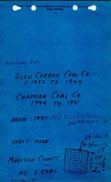
| Glen Carbon Coal Company, Inc. | Glen Carbon | 1932-1943 | 432,900 |
| Chapman Coal Company | Chapman No. 1 | 1944-1951 | 388,499 |
| Bluff Coal Company | Bluff No. 1 | 1952-1955 | 27,714 |
| Glen Carbon Mines, Inc. | Glen Carbon No. 1 | 1956-1958 | 52,957 |
| Total Production: 902,070 | |||
Production Notes
Coal Report production (if available)
Sources of Data
| Source Map | Map Date | Original Scale | Digitized Scale | Map Type |
| Microfilm, document 352384 | 12-12-1955 | 1:2400 | 1:4303 | Not final |
| Company map | 8-20-1958 | 1:2400 | 1:2400 | Final |
Annotated Bibliography (Data source - brief description of information)
| Coal Reports - Production, ownership, years of operation. |
| Directory of Illinois Coal Mines (Madison County) - Mine names, mine index, ownership, years of operation. |
| Mine notes (Madison County) - Mine type, shaft location, seam, depth, thickness. |
| Microfilm map, document 352384, reel 03139, frame 21 - Shaft locations, mine outline, mining method. |
| Company map, loan courtesy of Marissa Historical & Genealogical Society - Mine outline (northeastern), geologic problems. |
Mine Notes
Mine Images


Photographs