Monks Mound Quadrangle
Mining in the Monks Mound Quadrangle
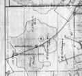
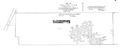
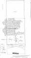
Mining in the Monks Mound Quadrangle began prior to 1874 and continued until 1958, and was exclusively in the Herrin Coal. No geologic problems were reported for the mines in this quadrangle, but the general characteristics of the Herrin Coal for this area probably prevailed - small slips and faults in the coal and roof materials and occasional coal balls in the roof. The mines were from 12 to 195 feet deep, and the Herrin Coal ranged from 3 to 7 feet thick, generally averaging between 5 and 6 feet.
The longest operating mine in this quadrangle was the Bunker Hill Mine (mine index 2767), which produced from 1911 to 1953.
Map and Directory PDF Download
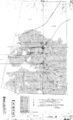
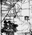
Coal Mines In Illinois Monks Mound Quadrangle
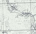
Mines that Appear on the Monks Mound Quadrangle
Unlocated Mines
St. Clair County
Madison County
Pages in category "Monks Mound Quadrangle"
The following 29 pages are in this category, out of 29 total.
Media in category "Monks Mound Quadrangle"
The following 25 files are in this category, out of 25 total.
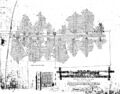
 M0192 352364.jpg 3,984 × 2,781; 1.65 MB
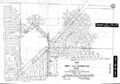
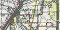
 M0192 IL1090.jpg 3,390 × 3,211; 1.43 MB
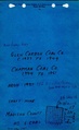
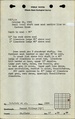
 M0192 minenotes.pdf 731 × 1,202, 10 pages; 2.53 MB
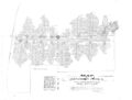
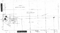
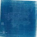 M2756 maplib.jpg 3,390 × 3,358; 2.71 MB
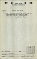
 M2756 minenotes.pdf 733 × 1,202, 5 pages; 1.17 MB
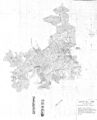
 M2757 352384.jpg 3,312 × 2,589; 2.11 MB
 M2757 minenotes.pdf 733 × 1,202, 3 pages; 764 KB
 M2757final.jpg 3,390 × 2,564; 1.01 MB
 M2767 352366.jpg 2,730 × 3,390; 1.97 MB
 M2767 minenotes.pdf 731 × 1,202, 5 pages; 1.16 MB
 M2768 352361.jpg 2,059 × 3,390; 1.41 MB
 M2768 minenotes.pdf 731 × 1,202, 6 pages; 1.32 MB
 M3601 coalreport1884 p568.pdf 1,589 × 1,247; 373 KB
 M3601alt.jpg 1,305 × 1,207; 411 KB
 M3602 minenotes.pdf 737 × 1,183, 2 pages; 370 KB
 M3603 351020.jpg 3,390 × 1,398; 272 KB
 M3603 minenotes.pdf 737 × 1,183, 5 pages; 1,015 KB
 M3603 wpa.jpg 593 × 651; 147 KB
 M3605 351019.jpg 1,828 × 3,390; 538 KB
 M3605 minenotes.pdf 737 × 1,183, 4 pages; 792 KB
 M4269 atlas1874.jpg 1,099 × 1,056; 242 KB
 M4269 fieldnotes.pdf 752 × 1,197, 3 pages; 526 KB
 M4326 flb.jpg 459 × 231; 46 KB
 M5022 351124.jpg 3,390 × 1,889; 547 KB
 M5022 fieldnotes.pdf 747 × 1,193; 182 KB


