Mine Index Number: 5022
| Company Name:
|
Emil Kramer
|
| Mine Name:
|
Drift Mine
|
| Start Date:
|
Pre 1899
|
End Date:
|
1913
|
| Type of Mine:
|
Underground
|
| Total acres shown:
|
7
|
| Acres after map date:
|
1
|
General Area of mining acres shown:
|
|
|
|
Shaft, Slope, Drift or Tipple Location(s)
| Type
|
County
|
Township-Range
|
Section
|
Part Section
|
| Shaft
|
St. Clair
|
2N 8W
|
18
|
NE NE NW
|
| Air shaft
|
St. Clair
|
2N 8W
|
18
|
NE NE NW
|
| Air shaft (proposed?)
|
St. Clair
|
2N 8W
|
18
|
NW NW NE
|
Geology
Geological Problems Reported
Production
| Company
|
Mine Name
|
Date
|
Production (tons)
|
| Drift Coal Company The source map has earlier survey dates of 6-10-1899 and 5-4-1904. The Coal Reports did not list production for Drift Coal Company in those years. Presumably the mine operated under another (unknown) operator or mine name.
|
Drift
|
pre 1907-1910
|
3,715
|
|
|
| Emil Kramer
|
Drift
|
1910-1913
|
5,691 Production since map date, mine reported idle 1913.
|
|
|
Production Notes
Coal Report production (if available)
Sources of Data
| Microfilm, document 351124
|
1-25-1910
|
1:1200
|
1:1655
|
Not final
|
Annotated Bibliography (Data source - brief description of information)
| Coal Reports - Production, ownership, years of operation, type, seam, depth, thickness.
|
| Directory of Illinois Coal Mines (St. Clair County) - Mine names, mine index, ownership, years of operation.
|
| Microfilm map, document 351124, reel 03134, frame 258 - Shaft locations, mine outline, mining method.
|
Mine Notes
Mine Images
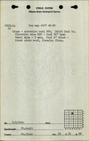
Microfilm: 351124
Map Date: 1-25-1910
Coal Co.: Emil Kramer
Mine Name: Drift Mine
Full Res Download
Photographs