Mine Index Number: 3605
| Company Name:
|
New St. Clair Coal Company
|
| Mine Name:
|
New St. Clair Mine
|
| Start Date:
|
1928
|
End Date:
|
1939
|
| Type of Mine:
|
Underground
|
| Total acres shown:
|
36
|
| Acres after map date:
|
|
General Area of mining acres shown:
|
|
|
|
Shaft, Slope, Drift or Tipple Location(s)
| Type
|
County
|
Township-Range
|
Section
|
Part Section
|
| Main shaft
|
St. Clair
|
2N 8W
|
17
|
NW SE NE
|
Geology
Geological Problems Reported
"Squeeze" is noted on the source map in the northern and western parts of the mine. The "very old works" are also designated as filled with water in the southwestern part of the mine.
Production
| Company
|
Mine Name
|
Date
|
Production (tons)
|
| New St. Clair Coal Company
|
New St. Clair
|
1928-1939
|
146,828 The source map for this mine shows an area labeled "very old works", indicating that mining took place at this location prior to 1928. The extent of these old works is unknown. Text was added to the accompanying map to show the location of the old works.
|
|
|
|
|
|
|
|
| Total Production: 146,828
|
Production Notes
Coal Report production (if available)
Sources of Data
| Microfilm, document 351019
|
7-1939
|
1:1200
|
1:2317
|
Final
|
Annotated Bibliography (Data source - brief description of information)
| Coal Reports - Production, ownership, years of operation.
|
| Directory of Illinois Coal Mines (St. Clair County) - Mine names, mine index, ownership, years of operation.
|
| Microfilm map, document 351019, reel 03134, frame 96 - Shaft location, mine outline, mining method.
|
| Mine notes (St. Clair County) - Thickness, depth, seam, mine type, shaft location.
|
Mine Notes
Mine Images
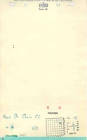
Microfilm: 351019
Map Date: 7-1-1939
Coal Co.: New St. Clair Coal Company
Mine Name: New St. Clair Mine
Full Res Download
Photographs