4071: Difference between revisions
No edit summary |
No edit summary |
||
| Line 81: | Line 81: | ||
|Digitized Scale=1:1200 | |Digitized Scale=1:1200 | ||
|Map Type=Not final | |Map Type=Not final | ||
}} | }} | ||
{{Annotated bibliography header}} | {{Annotated bibliography header}} | ||
| Line 101: | Line 94: | ||
{{Annotated bibliography | {{Annotated bibliography | ||
|bibliography=State archive map, IL_1448_01 - Slope location, mine outline, mining method. | |bibliography=State archive map, IL_1448_01 - Slope location, mine outline, mining method. | ||
}} | }} | ||
==Mine Notes== | ==Mine Notes== | ||
Latest revision as of 15:31, June 26, 2023
Mine Index Number: 4071
| Company Name: | B. and J. Coal Company | ||
|---|---|---|---|
| Mine Name: | B. and J. Mine | ||
| Start Date: | 1939 | End Date: | June 1948 |
| Type of Mine: | Underground | ||
| Total acres shown: | 20 | ||
| Acres after map date: | 10 These acres may be in the general area of mining south of the mapped mine outline. | General Area of mining acres shown: | |
Shaft, Slope, Drift or Tipple Location(s)
| Type | County | Township-Range | Section | Part Section |
|---|
| Main slope | Williamson | 9S 3E | 24 | NW NE NE |
Geology
| Thickness (ft) | |||||
|---|---|---|---|---|---|
| Seam | Depth (ft) | Min | Max | Ave | Mining Method |
| Springfield | 110-150 | 4.0-4.33 | RP |
Geological Problems Reported
Production
| Company | Mine Name | Date | Production (tons) |
| New Black Diamond Coal Company | New Black Diamond No. 5,A Mine | 1939-1943 | 88,191 |
| New Black Diamond Coal Company | New Black Diamond No. 5 | 1943-1947 Idle 1945. | 27,018 Production after map date. |
| B. and J. Coal Company | B. and J. | 1947-1948 | 12,559 Production after map date |
| Total Production: 127,768 | |||
Production Notes
Coal Report production (if available)
Sources of Data
| Source Map | Map Date | Original Scale | Digitized Scale | Map Type |
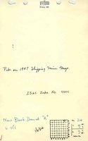
| State archive, IL_1448_01 | 4-9-1944 | 1:1200 | 1:1200 | Not final |
Annotated Bibliography (Data source - brief description of information)
| Coal Reports - Production, ownership, years of operation, depth, thickness. |
| Directory of Illinois Coal Mines (Williamson County) - Mine names, mine index, ownership, years of operation. |
| Mine notes (Williamson County) - Mine type, slope location, seam, depth, thickness. |
| State archive map, IL_1448_01 - Slope location, mine outline, mining method. |
Mine Notes
Mine Images
![[[:A Mine|A Mine]]](https://wikiimage.isgs.illinois.edu/ilmines/williamson/thumbnails/m4071_il_1448_01_th.jpg)
Photographs