4152: Difference between revisions
Alan.Myers (talk | contribs) No edit summary |
No edit summary |
||
| Line 8: | Line 8: | ||
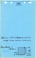
|Mine Name Header=Black No. 2 Mine | |Mine Name Header=Black No. 2 Mine | ||
|mine_type=Underground | |mine_type=Underground | ||
|mined-out-area=None | |mined-out-area=None | ||
|after_map=17 | |||
|indicated=Yes | |||
|county1=Williamson | |county1=Williamson | ||
|quad1=Carrier Mills | |quad1=Carrier Mills | ||
|city1=Harrisburg | |||
|year-start=1947 | |year-start=1947 | ||
|year-end=March 1950 | |year-end=March 1950 | ||
Revision as of 14:45, March 13, 2024
Mine Index Number: 4152
| Company Name: | Regenhardt and Southern Construction Company | ||
|---|---|---|---|
| Mine Name: | Black No. 2 Mine | ||
| Start Date: | 1947 | End Date: | March 1950 |
| Type of Mine: | Underground | ||
| Total acres shown: | None | ||
| Production Indicated Acres: | 17 | General Area of mining acres shown: | |
Shaft, Slope, Drift or Tipple Location(s)
| Type | County | Township-Range | Section | Part Section |
|---|
| Pit | Williamson | 9S 4E | 36 | SE NE NW This company may also have mined part of the pit in NE NW NW 36-T9S-R4E. The source map was too unclear to rule this out. |
Geology
| Thickness (ft) | |||||
|---|---|---|---|---|---|
| Seam | Depth (ft) | Min | Max | Ave | Mining Method |
| Herrin | 12-35 | 4.87-5.92 | Surface |
Geological Problems Reported
Production
| Company | Mine Name | Date | Production (tons) |
| Regenhardt and Southern Construction Company | Black No. 2 | 1947-1950 | 145,145 |
| Total Production: 145,145 | |||
Production Notes
Coal Report production (if available)
Sources of Data
| Source Map | Map Date | Original Scale | Digitized Scale | Map Type |
| Microfilm, document 353241 * The map has no valid georegistration points, being more a sketch than a map, so an uncertain location point was used. | Undated | 1:4800 | 1:5800 | Undated |
Annotated Bibliography (Data source - brief description of information)
| Coal Reports - Production, ownership, years of operation. |
| Directory of Illinois Coal Mines (Williamson County) - Mine names, mine index, ownership, years of operation. |
| Mine notes (Williamson County) - Mine type, seam, depth, thickness. |
| Microfilm map, document 353241, reel 03142, frame 182 - General location of mining, mining method. |
Mine Notes
Mine Images

Photographs