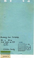
Mine Index 0974   Monterey Coal Company,   Monterey No. 2 Mine

From ILMINES WIKI
Revision as of 16:33, June 2, 2022 by Alan.Myers (talk | contribs)
Disclaimer
INTERPRETING A MINE SUMMARY SHEET
Unlocated Mines In: Clinton unlocated
County: Clinton
Quadrangle: Trenton
Breese
Okawville
County Coal Data: Clinton
Shown On Map: Yes
Unlocated: No
MSHA ID: 1102371

Mine Index Number: 0974

Company Name: Monterey Coal Company
Mine Name: Monterey No. 2 Mine
Start Date: 1977 End Date: 1996
Type of Mine: Underground
Total acres shown: 7,565
Acres after map date: General Area of mining acres shown:

Shaft, Slope, Drift or Tipple Location(s)

Type County Township-Range Section Part Section
Main slope Clinton 1N 5W 13 NW SW SE
Air/escape shaft Clinton 1N 5W 13 NW SW SE
Air shaft Clinton 1N 5W 13 SE SW SW

Geology

Thickness (ft)
Seam Depth (ft) Min Max Ave Mining Method
Herrin 330 6.0-7.0 BRP

Geological Problems Reported

Large slips which weaken the roof are common in the gray shale. Most of the roof is black Anna Shale; the gray shale occurs in pods. A series of slips occurs in the Anna Shale; this made an unstable roof. Roof falls were generally minor, as bolting to limestone (30 inches to 17 feet up) was the common practice. This was interpreted not as a roof control problem, but rather that the miners must wait for the bolter when the 17-foot bolts were required. Some of the bolts failed 9 years later, and the map shows numerous roof falls. Rolls were reported where both top comes down and the bottom comes up. At least one large clay dike was present, which pinched out in about the middle of the seam. A large clay-dike (not tectonic) fault is present, with a throw of about 5 feet, with another series of parallel slips (seriously weakening the roof). The map shows several faulted areas with 5 to 10 feet of displacement. Gas emission was high on freshly-mined face. High reject partings were present in the north and east parts of mine.

Production

Company Mine Name Date Production (tons)
Monterey Coal Company Monterey No. 2 1977-1996 46,677,010

Production Notes

Coal Report production (if available)

Sources of Data

Source Map Map Date Original Scale Digitized Scale Map Type
Company 7-19-1996 1:4800 1:4800 Final

Annotated Bibliography (Data source - brief description of information)

Coal Reports - Production, ownership, years of operation, seam, depth, thickness.
Directory of Illinois Coal Mines (Clinton County) - Mine names, mine index, ownership, years of operation.
ENR Document 85/01 - Mining method.
Mine notes (Clinton County) - Mine type, shaft location and size, seam, depth, thickness, geologic problems.
Company map, Coal Section files - Mine outline, shaft locations, mining method, geologic problems.

Mine Notes

Mine Images

[[:Monterey No. 2|Monterey No. 2]]These files may not be true to scale and are not georgistered. Map Type: Company
Map ID: 6-334
Company: Monterey Coal Company
Mine Name: Monterey No. 2
Caption:
Map Date: 08/09/1996
Map Status: Final
Image Credit:
Note: Map posted to 07-19-1996

Last day of Production 07-19-1996
Secondary Map source for Consolidated Coal Company of St. Louis, Trenton Mine (Mine index 2047)

More Info: M0974
Full Res Download:These files are true to scale and most are georegistered for gis software. These files may be a very large (>1GB) download! https://wikiimage.isgs.illinois.edu/ilmines/clinton/m0974.zip
[[:Monterey No. 2|Monterey No. 2]]These files may not be true to scale and are not georgistered. Map Type: Company
Map ID: 6-323
Company: Monterey Coal Company
Mine Name: Monterey No. 2
Caption:
Map Date: 01-01-1989
Map Status: Not Final
Image Credit:
Note: Map not georegistered
More Info: M0974 6-323
Full Res Download:These files are true to scale and most are georegistered for gis software. These files may be a very large (>1GB) download! https://wikiimage.isgs.illinois.edu/ilmines/clinton/m0974 6-323.jpg
[[:Monterey No. 2|Monterey No. 2]]These files may not be true to scale and are not georgistered. Map Type: 0974
Map ID: 6-322
Company: Monterey Coal Company
Mine Name: Monterey No. 2
Caption:
Map Date: 01-01-1991
Map Status: Not Final
Image Credit:
Note: Map not georegistered
More Info: M0974 6-322
Full Res Download:These files are true to scale and most are georegistered for gis software. These files may be a very large (>1GB) download! https://wikiimage.isgs.illinois.edu/ilmines/clinton/m0974 1-42-49.jpg
[[:Monterey No. 2|Monterey No. 2]]These files may not be true to scale and are not georgistered. Map Type: Company
Map ID: 1-42-46
Company: Monterey Coal Company
Mine Name: Monterey No. 2
Caption:
Map Date: 5-1-1995
Map Status: Not Final
Image Credit:
Note: Map not georegistered
More Info: M0974 1995
Full Res Download:These files are true to scale and most are georegistered for gis software. These files may be a very large (>1GB) download! https://wikiimage.isgs.illinois.edu/ilmines/clinton/m0974 1995.jpg
[[:Monterey No. 2|Monterey No. 2]]These files may not be true to scale and are not georgistered. Map Type: Company
Map ID: 1-42-48
Company: Monterey Coal Company
Mine Name: Monterey No. 2
Caption:
Map Date: 1-1-1987
Map Status: Not Final
Image Credit:
Note: Map not georegistered
More Info: M0974 1987
Full Res Download:These files are true to scale and most are georegistered for gis software. These files may be a very large (>1GB) download! https://wikiimage.isgs.illinois.edu/ilmines/clinton/m0974 1987.jpg
[[:Monterey No. 2|Monterey No. 2]]These files may not be true to scale and are not georgistered. Map Type: Company
Map ID: 1-42-47
Company: Monterey Coal Company
Mine Name: Monterey No. 2
Caption:
Map Date: 1-1-1985
Map Status: Not Final
Image Credit:
Note: Map not georegisted
More Info: M0974 1985
Full Res Download:These files are true to scale and most are georegistered for gis software. These files may be a very large (>1GB) download! https://wikiimage.isgs.illinois.edu/ilmines/clinton/m0974 1985.jpg
[[:Monterey No. 2|Monterey No. 2]]These files may not be true to scale and are not georgistered. Map Type: Company
Map ID: 1-42-49
Company: Monterey Coal Company
Mine Name: Monterey No. 2
Caption:
Map Date: 01-01-1979
Map Status: Not Final
Image Credit:
Note: Map not georegistered
More Info: M0974 1-42-49
Full Res Download:These files are true to scale and most are georegistered for gis software. These files may be a very large (>1GB) download! https://wikiimage.isgs.illinois.edu/ilmines/clinton/m0974 6-322.jpg

Photographs