0981: Difference between revisions
No edit summary |
Alan.Myers (talk | contribs) No edit summary |
||
| Line 13: | Line 13: | ||
|year-start=1980 | |year-start=1980 | ||
|year-end=1993 | |year-end=1993 | ||
|Latitude= | |Latitude=37.82928031 | ||
|Longitude= | |Longitude=-88.74236587 | ||
|Zoom=15 | |Zoom=15 | ||
}} | }} | ||
| Line 48: | Line 48: | ||
|Date=1980-1983 {{#info: Idle 1984-1989.|note}} | |Date=1980-1983 {{#info: Idle 1984-1989.|note}} | ||
|Production=37,093 | |Production=37,093 | ||
|Sum=No | |||
}} | }} | ||
{{Production | {{Production | ||
| Line 54: | Line 55: | ||
|Date=1990-1991 | |Date=1990-1991 | ||
|Production=86,995 | |Production=86,995 | ||
|Sum=No | |||
}} | }} | ||
{{Production | {{Production | ||
| Line 60: | Line 62: | ||
|Date=1992-1993 | |Date=1992-1993 | ||
|Production=100,189 | |Production=100,189 | ||
|Sum=No | |||
| | |||
}} | }} | ||
{{Production | {{Production | ||
|Production=224,277 | |Production=224,277 | ||
|Sum=Yes | |||
}} | }} | ||
===Production Notes=== | ===Production Notes=== | ||
Revision as of 16:05, April 12, 2022
Mine Index Number: 0981
| Company Name: | Phoenix Mining Company | ||
|---|---|---|---|
| Mine Name: | Phoenix No. 1 Mine | ||
| Start Date: | 1980 | End Date: | 1993 |
| Type of Mine: | Surface | ||
| Total acres shown: | 90 The area shown is disturbed land that appears to have been surface-mined by Malone No. 1 Mine (mine index 939) and the Corinth/Phoenix Mine. The production of the Malone No. 1 Mine indicates that approximately 3 acres were mined and approximately 50 acres were mined by the Phoenix Mine. | ||
| Acres after map date: | General Area of mining acres shown: | ||
Shaft, Slope, Drift or Tipple Location(s)
| Type | County | Township-Range | Section | Part Section |
|---|
| Tipple / pit | Williamson | 8S 4E | 14 | NW SW NW |
Geology
| Thickness (ft) | |||||
|---|---|---|---|---|---|
| Seam | Depth (ft) | Min | Max | Ave | Mining Method |
| Womac | 15-35 | 2.5-2.9 | Surface |
Geological Problems Reported
The overburden was soft and thin. The coal had very low sulfur content, as low as 0.6%, and was used by the Sahara Coal Company to blend with their higher sulfur coals. The lower bench of the coal (2 inches thick) was not mined because the quality was low, with high ash and sulfur contents.
Production
| Company | Mine Name | Date | Production (tons) |
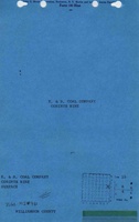
| E. and B. Coal Company The ISGS mine notes indicate E. and B. Coal Company bought the Malone No. 1 Mine (mine index 939), but the mine notes gave different locations for the pits. Two index numbers are used, since it appears the Malone Mine was shut down and a new mine begun nearby. These three-digit index numbers relate to chemical analyses in other databases and are retained, even when the separate mines cannot be distinguished on the accompanying map and their histories are intertwined. | Corinth | 1980-1983 Idle 1984-1989. | 37,093 |
| Phoenix Mining Company | Corinth No. 1 | 1990-1991 | 86,995 |
| Phoenix Mining Company | Phoenix No. 1 | 1992-1993 | 100,189 |
| Total Production: 224,277 | |||
Production Notes
Coal Report production (if available)
Sources of Data
| Source Map | Map Date | Original Scale | Digitized Scale | Map Type |
| USGS digital orthophoto quadrangle | 1998-1999 | 1:12000 | 1:12000 | Secondary source |
Annotated Bibliography (Data source - brief description of information)
| Coal Reports - Production, ownership, years of operation, seam, depth, thickness. |
| Directory of Illinois Coal Mines (Williamson County) - Mine names, mine index, ownership, years of operation. |
| Mine notes (Williamson County) - Mine type, tipple / pit location, seam, geologic problems. |
| USGS digital ortho-photo quadrangle, Harco Quadrangle - General mine outline. |
Mine Notes
Mine Images

Photographs