1019: Difference between revisions
Alan.Myers (talk | contribs) No edit summary |
No edit summary |
||
| (2 intermediate revisions by one other user not shown) | |||
| Line 1: | Line 1: | ||
{{Sidebar Info Query}} | {{Sidebar Info Query}} | ||
{{Header | {{Header | ||
|checked=Checked OK | |||
|unlocated=No | |unlocated=No | ||
|shown_on_map=Yes | |shown_on_map=Yes | ||
| Line 7: | Line 8: | ||
|Mine Name Header=Cottonwood No. 1 Mine | |Mine Name Header=Cottonwood No. 1 Mine | ||
|mine_type=Surface | |mine_type=Surface | ||
|mined-out-area=13 | |mined-out-area=None | ||
|after_map=13 | |||
|indicated=No | |||
|county1=Williamson | |county1=Williamson | ||
|quad1=Johnston City | |quad1=Johnston City | ||
| Line 52: | Line 55: | ||
|Date=1996-1997 | |Date=1996-1997 | ||
|Production=72,584 | |Production=72,584 | ||
|Sum=Yes | |||
| | |||
}} | }} | ||
===Production Notes=== | ===Production Notes=== | ||
| Line 66: | Line 64: | ||
{{Source map header}} | {{Source map header}} | ||
{{Source Map | {{Source Map | ||
|Source Map= | |Source Map=Nelson, Catalog of Coal Mines | ||
|Map Date=2003 | |Map Date=2003 | ||
|Original Scale=(text only) | |Original Scale=(text only) | ||
| Line 85: | Line 83: | ||
}} | }} | ||
{{Annotated bibliography | {{Annotated bibliography | ||
|bibliography=Catalog of Coal Mines in Williamson County | |bibliography=W.J. Nelson (ISGS), Catalog of Coal Mines in Williamson County - Mine locations. | ||
}} | }} | ||
{{Annotated bibliography | {{Annotated bibliography | ||
| Line 96: | Line 94: | ||
{{Query-image}} | {{Query-image}} | ||
===Photographs=== | |||
{{Photo Query}} | |||
{{Editwithform}} | {{Editwithform}} | ||
{{#set: Company=Gordon and Price Coal Company }} | {{#set: Company=Gordon and Price Coal Company }} | ||
{{#set: Mine-Name=Pace No. 1}} | {{#set: Mine-Name=Pace No. 1}} | ||
{{Editwithform}} | |||
Latest revision as of 15:44, August 1, 2022
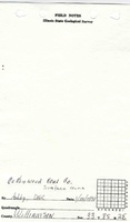
Mine Index Number: 1019
| Company Name: | Cottonwood Coal Company | ||
|---|---|---|---|
| Mine Name: | Cottonwood No. 1 Mine | ||
| Start Date: | 1996 | End Date: | 1997 |
| Type of Mine: | Surface | ||
| Total acres shown: | None | ||
| Acres after map date: | 13 | General Area of mining acres shown: | |
Shaft, Slope, Drift or Tipple Location(s)
| Type | County | Township-Range | Section | Part Section |
|---|
| Tipple / pit | Williamson | 8S 2E | 33 | SW NE |
| Pit | Williamson | 9S 2E | 4 | SW NE |
Geology
| Thickness (ft) | |||||
|---|---|---|---|---|---|
| Seam | Depth (ft) | Min | Max | Ave | Mining Method |
| Springfield | 70 | 4.0 | Surface |
Geological Problems Reported
Production
| Company | Mine Name | Date | Production (tons) |
| Cottonwood Coal Company This is also the location of a mine known as Gordon & Price Coal Company, Pace No. 1 Mine that operated around 1999 and re-mined areas surface-mined by earlier operators. | Cottonwood No. 1 | 1996-1997 | 72,584 |
| Total Production: 72,584 | |||
Production Notes
Coal Report production (if available)
Sources of Data
| Source Map | Map Date | Original Scale | Digitized Scale | Map Type |
| Nelson, Catalog of Coal Mines | 2003 | (text only) | 1:24000 Point plotted onto 1:24,000 USGS topographic map and digitized. | Secondary source |
| Coal Section files, 10-9-3 | 2003 | Secondary source |
Annotated Bibliography (Data source - brief description of information)
| Coal Reports - Production, ownership, years of operation, seam, depth, thickness, mining method. |
| Directory of Illinois Coal Mines (Williamson County) - Mine names, mine index, ownership, years of operation. |
| W.J. Nelson (ISGS), Catalog of Coal Mines in Williamson County - Mine locations. |
| Aerial photograph enlargement and DMM permit outline, Coal Section files 10-9-3 - Mine location. |
Mine Notes
Mine Images


Photographs