Mine Index Number: 0081
| Company Name:
|
Perry Coal Company
|
| Mine Name:
|
Taylor Mine
|
| Start Date:
|
1889
|
End Date:
|
January 1932
|
| Type of Mine:
|
Underground
|
| Total acres shown:
|
633
|
| Acres after map date:
|
12
|
General Area of mining acres shown:
|
|
|
|
Shaft, Slope, Drift or Tipple Location(s)
| Type
|
County
|
Township-Range
|
Section
|
Part Section
|
| Main shaft
|
St. Clair
|
2N 8W
|
24
|
NE SW SW
|
| Air shaft
|
St. Clair
|
2N 8W
|
24
|
NE SW SW
|
Geology
| Herrin
|
200-212
|
6.5
|
8.0
|
7.0
|
MRP
|
Geological Problems Reported
The roof was generally limestone with some areas of black shale, mostly on the western side of the mine. The areas of black shale had many slips and the roof was hard to hold. The mine was dry, or the floor clay would heave.
Production
| Company
|
Mine Name
|
Date
|
Production (tons)
|
|
|
|
|
|
| Total Production: 4,578,415
|
Production Notes
Coal Report production (if available)
Sources of Data
| Microfilm, document 351074
|
3-1-1930
|
1:2400
|
1:4140
|
Not final
|
| State archive, IL_421
|
4-2-1931
|
1:2400
|
1:2400
|
Not final
|
| State archive, IL_419
|
8-2-1931
|
1:2400
|
1:2400
|
Not final
|
Annotated Bibliography (Data source - brief description of information)
| Coal Reports - Production, ownership, years of operation.
|
| Directory of Illinois Coal Mines (St. Clair County) - Mine names, mine index, ownership, years of operation.
|
| Microfilm map, document 351074, reel 03134, frames 177,178 - Shaft locations, mine outline, mining method.
|
| Mine notes (St. Clair County) - Shaft location, seam, depth, thickness, geologic problems.
|
| State archive, IL_419 - Mine outline (eastern).
|
| State archive, IL_421 - Mine outline (eastern).
|
| Federal Land Bank Report (St. Clair County) - Depth.
|
Mine Notes
Mine Images
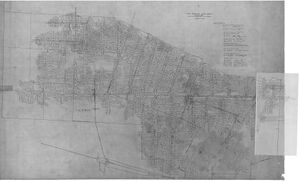
Company: IL_419 and IL_421
Map Date: 4-2-1931
Coal Co.: Perry Coal Company
Mine Name: Taylor Mine
Image Credit: Illinois Department of Natural Resources - Office of Mines and Minerals
Full Res Download
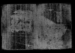
Microfilm: 351074
Map Date: 3-1-1930
Coal Co.: Perry Coal Company
Mine Name: Taylor Mine
Full Res Download
Photographs


