Mine Index Number: 0203
| Company Name:
|
Oak Coal Company
|
| Mine Name:
|
Little Oak Mine
|
| Start Date:
|
1904
|
End Date:
|
June 1948
|
| Type of Mine:
|
Underground
|
| Total acres shown:
|
1,018
|
| Acres after map date:
|
|
General Area of mining acres shown:
|
|
|
|
Shaft, Slope, Drift or Tipple Location(s)
| Type
|
County
|
Township-Range
|
Section
|
Part Section
|
| Main shaft
|
St. Clair
|
1N 7W
|
18
|
NE NW SW
|
| Air shaft
|
St. Clair
|
1N 7W
|
18
|
NW NW SW
|
Geology
| Herrin
|
124-128
|
5.0
|
10.0
|
6.5
|
MRP
|
Geological Problems Reported
Slips were quite common, with offsets up to 2 feet. Rolls were rare. The floor clay heaved a little, but did not give much trouble.
Production
| Company
|
Mine Name
|
Date
|
Production (tons)
|
|
|
|
|
|
| Total Production: 6,587,629
|
Production Notes
Coal Report production (if available)
Sources of Data
| Microfilm, document 351038
|
2-22-1946
|
1:2400
|
1:4303
|
Not final The mined area shown on the accompanying map is the approximate size expected for the production reported. This suggests that the mine outline is complete.
|
| Microfilm, document 351037
|
11-24-1948
|
1:2400
|
1:4634
|
Final
|
Annotated Bibliography (Data source - brief description of information)
| Coal Reports - Production, ownership, years of operation.
|
| Directory of Illinois Coal Mines (St. Clair County) - Mine names, mine index, ownership, years of operation.
|
| Mine notes (St. Clair County) - Shaft locations, seam, depth, thickness, geologic problems.
|
| Microfilm map, document 351038, reel 03134, frames 123-126 - Shaft locations, mine outline, mining method.
|
| Microfilm map, document 351037, reel 03134, frame 122 - Mine outline (western).
|
Mine Notes
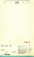
Mine Images
![[[:Little Oak|Little Oak]]](https://go.illinois.edu/ILMImages/st_clair/thumbnails/m0203mrg_th.jpg) These files may not be true to scale and are not georgistered. These files may not be true to scale and are not georgistered.
|
Map Type:
|
Microfilm
|
| Map ID:
|
351038
|
| Company:
|
Oak Coal Company
|
| Mine Name:
|
Little Oak
|
| Caption:
|
|
| Map Date:
|
2-22-1946
|
| Map Status:
|
Not final
|
| Image Credit:
|
|
| Note:
|
Shaft locations, mine outline, mining method.
|
| More Info:
|
M0203mrg
|
| Full Res Download:These files are true to scale and most are georegistered for gis software. These files may be a very large (>1GB) download!
|
https://wikiimage.isgs.illinois.edu/ilmines/st clair/m0203mrg.zip
|
![[[:Little Oak|Little Oak]]](https://go.illinois.edu/ILMImages/st_clair/thumbnails/m0203_th.jpg) These files may not be true to scale and are not georgistered. These files may not be true to scale and are not georgistered.
|
Map Type:
|
Microfilm
|
| Map ID:
|
351037
|
| Company:
|
Oak Coal Company
|
| Mine Name:
|
Little Oak
|
| Caption:
|
|
| Map Date:
|
11-24-1948
|
| Map Status:
|
Final
|
| Image Credit:
|
|
| Note:
|
Mine outline (western)
|
| More Info:
|
M0203
|
| Full Res Download:These files are true to scale and most are georegistered for gis software. These files may be a very large (>1GB) download!
|
https://wikiimage.isgs.illinois.edu/ilmines/st clair/m0203.zip
|
Photographs