Mine Index Number: 0258
| Company Name:
|
Edward Griffiths
|
| Mine Name:
|
Griffiths Mine
|
| Start Date:
|
1873
|
End Date:
|
1916
|
| Type of Mine:
|
Underground
|
| Total acres shown:
|
None
|
| Production Indicated Acres:
|
16
|
General Area of mining acres shown:
|
|
|
|
Shaft, Slope, Drift or Tipple Location(s)
| Type
|
County
|
Township-Range
|
Section
|
Part Section
|
| Main drift (1885-1894)
|
Greene
|
12N 11W
|
30
|
SE NW
|
| Shaft (1894-1916)
|
Greene
|
12N 11W
|
30
|
SE NW
|
Geology
| Colchester
|
28-42 (drift), 35-60 (shaft)
|
2.2
|
3.0
|
2.5
|
RP
|
Geological Problems Reported
A fault was present near the shaft bottom and was encountered in the workings. The fault extended 500 feet to the northwest and 160 feet southeast of the shaft bottom, where the fault changed course to nearly north-south. The coal was free of horsebacks or banding within the seam. The roof was black shale with pyrite concretions. Clod was sometimes as much as 3 feet thick, with a 2.0 to 4.5 foot thick limestone above the clod. The underclay was 12 feet thick.
Production
| Company
|
Mine Name
|
Date
|
Production (tons)
|
| E. Griffiths
|
Griffiths
|
circa 1873
|
unknown The area was shown as mined on the 1873 Greene County atlas, but operators between 1873 and the 1886 Coal Report could not be identified, and production and years of operation are not known. A polygon was constructed to include the mine shown on the atlas.
|
|
|
Production Notes
Coal Report production (if available)
Sources of Data
| Mine notes
|
1937
|
1:62500
|
1:62500
|
Secondary source
|
| Atlas map of Greene County, Illinois
|
1873
|
Unknown
|
1:24000
|
Secondary source
|
Annotated Bibliography (Data source - brief description of information)
| Coal Reports - Production, ownership, years of operation.
|
| Directory of Illinois Coal Mines (Greene County) - Mine names, mine index, ownership, years of operation.
|
| Mine notes (Greene County) - Mine type, drift & shaft locations, depth, thickness, mining method, geologic problems.
|
| Andreas, L. &. C., 1873, Atlas map of Greene County, Illinois. Davenport, Iowa: Andreas, Lyter & Co. [Map] Retrieved from the Library of Congress, https://www.loc.gov/item/2006628620/. - Ownership, years of operation, general area of mining.
|
Mine Notes
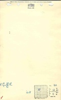
Mine Images
 These files may not be true to scale and are not georgistered. These files may not be true to scale and are not georgistered.
|
Map Type:
|
Atlas of Greene County, Illinois
|
| Map ID:
|
|
| Company:
|
|
| Mine Name:
|
|
| Caption:
|
|
| Map Date:
|
1873
|
| Map Status:
|
Secondary
|
| Image Credit:
|
|
| Note:
|
Andreas, L. &. C., 1873, Atlas map of Greene County, Illinois. Davenport, Iowa: Andreas, Lyter & Co. [Map] Retrieved from the Library of Congress, https://www.loc.gov/item/2006628620/.
|
| More Info:
|
M6433 geo
|
| Full Res Download:These files are true to scale and most are georegistered for gis software. These files may be a very large (>1GB) download!
|
https://go.illinois.edu/ILMImages/greene/m6433 geo.zip
|
Photographs