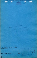
Mine Index Number: 0332
| Company Name:
|
Southern Coal Company
|
| Mine Name:
|
Southern No. 10 Mine
|
| Start Date:
|
1898
|
End Date:
|
July 7, 1910
|
| Type of Mine:
|
Underground
|
| Total acres shown:
|
40
|
| Acres after map date:
|
|
General Area of mining acres shown:
|
|
|
|
Shaft, Slope, Drift or Tipple Location(s)
| Type
|
County
|
Township-Range
|
Section
|
Part Section
|
| Main shaft The symbol on the source map indicates the hoist shaft may have been combined with an air shaft.
|
Clinton
|
1N 4W
|
3
|
NW SW SW
|
Geology
| Herrin
|
345-350
|
4.5
|
5.17
|
4.83
|
MRP
|
Geological Problems Reported
Production
| Company
|
Mine Name
|
Date
|
Production (tons)
|
| Southern Coal Company
|
Southern No. 10
|
1905-1909 The source map had the abandoned date scrawled across the mine outline. Although no production was listed in the 1909-1910 fiscal year Coal Report, some production may have occurred after the production listed above. Alternatively, the mine may have been idled but economic conditions did not warrant re-opening the mine, and the production shown may be the total removed from the mine before closure.
|
84,718
|
|
|
|
|
|
|
|
| Total Production: 276,477
|
Production Notes
Coal Report production (if available)
Sources of Data
| State archive, IL_474_01
|
7-7-1910
|
1:2400
|
1:4303
|
Final
|
Annotated Bibliography (Data source - brief description of information)
| Coal Reports - Production, ownership, years of operation, mining method.
|
| Directory of Illinois Coal Mines (Clinton County) - Mine names, mine index, ownership, years of operation.
|
| Mine notes (Clinton County) - Mine type, shaft location, seam, depth, thickness.
|
| Company map, state archive, IL_474_01 - Shaft location, mine outline, mining method.
|
Mine Notes
Mine Images
![[[:Southern No. 10|Southern No. 10]]](https://wikiimage.isgs.illinois.edu/ilmines/clinton/thumbnails/m0332_il_474_01_th.jpg) These files may not be true to scale and are not georgistered. These files may not be true to scale and are not georgistered.
|
Map Type:
|
Company
|
| Map ID:
|
IL 474 01
|
| Company:
|
Southern Coal Company
|
| Mine Name:
|
Southern No. 10
|
| Caption:
|
|
| Map Date:
|
July 7, 1910
|
| Map Status:
|
Final
|
| Image Credit:
|
|
| Note:
|
This image is the original map, from the state archive, for microfilm 351391, 3135, 457, 26X
|
| More Info:
|
M0332 il 474 01.jpg
|
| Full Res Download:These files are true to scale and most are georegistered for gis software. These files may be a very large (>1GB) download!
|
https://wikiimage.isgs.illinois.edu/ilmines/clinton/m0332 il 474 01.zip
|
Photographs