Mine Index Number: 0344
| Company Name:
|
Donk Brothers Coal and Coke Company
|
| Mine Name:
|
Donk No. 1 Mine
|
| Start Date:
|
1900
|
End Date:
|
January 31, 1921
|
| Type of Mine:
|
Underground
|
| Total acres shown:
|
1,221
|
| Acres after map date:
|
|
General Area of mining acres shown:
|
|
|
|
Shaft, Slope, Drift or Tipple Location(s)
| Type
|
County
|
Township-Range
|
Section
|
Part Section
|
| Main shaft
|
Madison
|
3N 8W
|
22
|
NW SW NW
|
| Air shaft
|
Madison
|
3N 8W
|
22
|
NE SW NW
|
Geology
Geological Problems Reported
Production
| Company
|
Mine Name
|
Date
|
Production (tons)
|
Production Notes
Coal Report production (if available)
Sources of Data
| Microfilm, document 352377
|
5-1921
|
1:2400
|
1:5131
|
Final
|
Annotated Bibliography (Data source - brief description of information)
| Coal Reports - Production, ownership, years of operation.
|
| Directory of Illinois Coal Mines (Madison County) - Mine names, mine index, ownership, years of operation.
|
| Mine notes (Madison County) - Mine type, shaft location, seam, depth, thickness.
|
| Microfilm map, document 352377, reel 03139, frames 1-3 - Shaft locations, mine outline, mining method, abandonment date.
|
Mine Notes
Mine Images
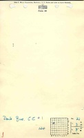
Microfilm: 352377
Map Date: 5-1921
Coal Co.: Donk Brothers Coal and Coke Company
Mine Name: Donk No. 1
Full Res Download
Photographs