Mine Index Number: 0370
| Company Name:
|
Osage Coal Company
|
| Mine Name:
|
Osage Mine
|
| Start Date:
|
1935
|
End Date:
|
1950
|
| Type of Mine:
|
Surface
|
| Total acres shown:
|
566
|
| Production Indicated Acres:
|
2
|
General Area of mining acres shown:
|
|
|
|
Shaft, Slope, Drift or Tipple Location(s)
| Type
|
County
|
Township-Range
|
Section
|
Part Section
|
| TipplePits for this mine are in N 1⁄2 17 and N 1⁄2 18, T33N-R3E, S 1⁄2 11, N 1⁄2 13 and N 1⁄2 14, T33N-R2E.
|
La Salle
|
33N 2E
|
13
|
NW SW
|
Geology
| Colchester
|
30-50
|
|
|
1.75-1.83
|
Surface
|
Geological Problems Reported
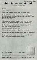
The overburden consisted of 2 to 5 feet of glacial till over shale. The pyrite content of the seam was high, with pyrite partings and pyrite veins in the joints.
Production
| Company
|
Mine Name
|
Date
|
Production (tons)
|
|
|
|
|
|
| Total Production: 1,399,342
|
Production Notes
Coal Report production (if available)
Sources of Data
| Company, 4103.L32 i5.1-7
|
3-12-1949
|
1:4800
|
1:4800
|
Not final
|
Annotated Bibliography (Data source - brief description of information)
| Coal Reports - Production, ownership, years of operation.
|
| Directory of Illinois Coal Mines (La Salle County) - Mine names, mine index, ownership, years of operation.
|
| Mine notes (La Salle County) - Mine type, mine location, seam, depth, thickness.
|
| ISGS field notes (La Salle County) - Geologic problems.
|
| Company map, ISGS map library, 4103.L32 i5.1-7 - Tipple location, mine outline, mining method.
|
Mine Notes
Mine Images
Photographs