Mine Index Number: 0657
| Company Name:
|
Wilmington Coal Mines, Inc.
|
| Mine Name:
|
Wilmington No. 4 Mine
|
| Start Date:
|
1913
|
End Date:
|
1941
|
| Type of Mine:
|
Surface
|
| Total acres shown:
|
144
|
| Production Indicated Acres:
|
65Other operators may have mined these pits (see the unlocated mines at the back of this report).
|
General Area of mining acres shown:
|
|
|
|
Shaft, Slope, Drift or Tipple Location(s)
| Type
|
County
|
Township-Range
|
Section
|
Part Section
|
| Tipple
|
La Salle
|
33N 4E
|
9
|
NW SE SW
|
| Pit
|
La Salle
|
33N 4E
|
8
|
SW NW NW
|
Geology
| Colchester
|
25
|
|
|
2.17-2.5
|
Surface
|
Geological Problems Reported
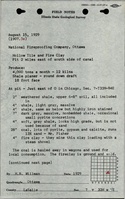
Concretions were found near the top of the coal seam. The upper 2-3 inches of the coal contained pyrite bands and a persistent gypsum band.
Production
| Company
|
Mine Name
|
Date
|
Production (tons)
|
| National Fire Proofing Company
|
Pioneer
|
1913-1934Idle 1919, 1926, 1931 and 1934. Production not reported in 1922 for mines producing less than 10,000 tons. Production not reported 1930-1933 for mines producing less than 1,000 tons per year, so National Fire Proofing Comapny may have had low production in 1931 instead of being idle.
|
49,171
|
|
|
|
|
|
|
|
| Total Production: 238,882
|
Production Notes
Coal Report production (if available)
Sources of Data
| Company, 6-261d
|
7-7-1941
|
1:31680
|
1:31680
|
Final
|
| Coal Section files
|
Undated
|
1:62500
|
1:62500
|
Secondary source
|
| USGS topographic map
|
1994
|
1:24000
|
1:24000
|
Secondary source
|
Annotated Bibliography (Data source - brief description of information)
| Coal Reports - Production, ownership, years of operation, depth, thickness, mining method.
|
| Directory of Illinois Coal Mines (La Salle County) - Mine names, mine index, ownership, years of operation.
|
| Mine notes (La Salle County) - Mine location, seam.
|
| ISGS field notes (La Salle County) - Geologic problems.
|
| Company map, Coal Section files 6-261d - General pit location (no coordinates to register the mine to land surface).
|
| Coal Section files, data sketched onto USGS Ottawa (15-minute) Quadrangle - Tipple location, general pit location.
|
| Ottawa Quadrangle, USGS 7.5-minute topographic map, 1994 - Mine outline.
|
Mine Notes
Mine Images
Photographs