Mine Index Number: 2025
| Company Name:
|
Sheffield Mining Company
|
| Mine Name:
|
Sheffield Mine
|
| Start Date:
|
1855
|
End Date:
|
1902
|
| Type of Mine:
|
Underground
|
| Total acres shown:
|
240
|
| Acres after map date:
|
|
General Area of mining acres shown:
|
|
|
Sheffield Mine was later partially surface mined by Midland Mine (mine index 0681).
|
Shaft, Slope, Drift or Tipple Location(s)
| Type
|
County
|
Township-Range
|
Section
|
Part Section
|
| Main slope
|
Bureau
|
16N 6E
|
24
|
NE SE SW
|
| Shaft
|
Bureau
|
16N 6E
|
24
|
SE NW SE
|
Geology
Geological Problems Reported
Numerous clay slips were present so that the usual room-and-pillar mining was altered to accommodate the problem. Entries were driven around a square block of coal and the rooms were driven in the best side of the block. The mine was abandoned because the distance from the working face to the shaft was too far for mule haulage (not because the reserves were exhausted).
Production
| Company
|
Mine Name
|
Date
|
Production (tons)
|
| Sheffield Mining Company The company was also known as Sheffield Mining and Transportation Company.
|
Sheffield
|
ca. 1855-1902 Production and years of operation before 1881 are unknown, but History of Bureau County (1885) stated the mine opened more than 30 years before. The 1882 Coal Report indicates 80 acres were mined.
|
393,766
|
|
|
|
|
|
|
|
| Total Production: 393,766
|
Production Notes
Coal Report production (if available)
Sources of Data
| Federal Land Bank Report
|
6-1935
|
1:126720
|
1:126720
|
Secondary source
|
Annotated Bibliography (Data source - brief description of information)
| Coal Reports - Production, ownership, years of operation, mine type, seam, depth, thickness, mining method, geologic problems.
|
| Directory of Illinois Coal Mines (Bureau County) - Mine names, mine index, ownership, years of operation.
|
| Mine notes (Bureau County) - Mine type, slope location.
|
| ISGS field notes (Bureau County) - Mine type, slope location.
|
| Bradsby, H. C., 1885, History of Bureau County, Illinois, World Publishing Company, Chicago, Illinois, 710p. - Years of operation.
|
| Federal Land Bank Report (Bureau County) - Slope and shaft locations, mine outline.
|
Mine Notes
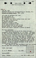
Mine Images
![[[:Sheffield|Sheffield]]](https://wikiimage.isgs.illinois.edu/ilmines/bureau/thumbnails/m2025_geo_th.jpg) These files may not be true to scale and are not georgistered. These files may not be true to scale and are not georgistered.
|
Map Type:
|
Federal Land Bank Report
|
| Map ID:
|
|
| Company:
|
Sheffield Mining Company
|
| Mine Name:
|
Sheffield
|
| Caption:
|
|
| Map Date:
|
6-1935
|
| Map Status:
|
Secondary source
|
| Image Credit:
|
|
| Note:
|
|
| More Info:
|
M2025 geo
|
| Full Res Download:These files are true to scale and most are georegistered for gis software. These files may be a very large (>1GB) download!
|
https://wikiimage.isgs.illinois.edu/ilmines/bureau/m2025 geo.zip
|
Photographs