Mine Index Number: 2074
| Company Name:
|
Coal Run Coal Company
|
| Mine Name:
|
Peanut Mine
|
| Start Date:
|
Circa 1873
|
End Date:
|
1884
|
| Type of Mine:
|
Underground
|
| Total acres shown:
|
22 Production indicates approximately 37 acres were mined, and the Coal Report indicated 65 acres were mined before production was reported, for a total of 102 acres. This may be included in the area designated General Area of Mining (by color symbol) on the accompanying map.
|
| Acres after map date:
|
|
General Area of mining acres shown:
|
|
|
|
Shaft, Slope, Drift or Tipple Location(s)
| Type
|
County
|
Township-Range
|
Section
|
Part Section
|
| Main shaft
|
La Salle
|
31N 3E
|
36
|
NE NW SW
|
Geology
Geological Problems Reported
In the spring of 1878, Coal Run Creek flooded and broke into the workings below a surface cave-hole. More than a hundred miners escaped, with only one fatality.
Production
| Company
|
Mine Name
|
Date
|
Production (tons)
|
| Coal Run Coal Company
|
Peanut
|
ca.1873-1884Production before July 1881 is not known. The 1882 Coal Report indicates 65 acres had been mined. Biography in Black, A History of Streator, Illinois indicates Colonel Ralph Plumb founded the Coal Run Coal Company after 1871 but before the mid-1870s.
|
165,000Production before July 1881 is not known. The 1882 Coal Report indicates 65 acres had been mined. Biography in Black, A History of Streator, Illinois indicates Colonel Ralph Plumb founded the Coal Run Coal Company after 1871 but before the mid-1870s.
|
|
|
|
|
|
|
|
| Total Production: 165,000
|
Production Notes
Coal Report production (if available)
Sources of Data
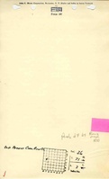
| Microfilm, mines07e.tif
|
Undated
|
1:1200
|
1:2800
|
Secondary source
|
| Microfilm, mines04d.tif
|
Undated
|
Unknown
|
1:840
|
Secondary source
|
| Microfilm, mines099.tif
|
Undated
|
1:3960
|
1:3960
|
Secondary source
|
| Microfilm, mines087.tif and mines 088.tif
|
Undated
|
1:4248
|
1:4248
|
Secondary source
|
| Paula Angle
|
1961
|
(text only)
|
1:24000The shaft was not shown on the map of the mine workings. The shaft location was taken from Biography in Black, A History of Streator, Illinois. The location was said to be on the west side of Vermilion Street, north of Coal Run Creek. An approximation of this location was plotted on a 1:24000 USGS topographic map and digitized.
|
Secondary source
|
Annotated Bibliography (Data source - brief description of information)
| Coal Reports - Production, ownership, years of operation, depth, thickness.
|
| Directory of Illinois Coal Mines (La Salle County) - Mine names, mine index, ownership, years of operation.
|
| Microfilm map, Coal Section files, mines07e.tif - Shaft locations, mine outline (southern part).
|
| Microfilm map, Coal Section files, mines04d.tif - Mine outline (northeastern part), mining method.
|
| Microfilm map, Coal Section files, mines099.tif - Mine outline (western side).
|
| Microfilm map, Coal Section files, mines087.tif & mines088.tif - Mine outline (northwestern side).
|
| Angle, Paula, 1962, Biography in Black: a History of Streator, Illinois, Weber Company, 170p. - Shaft location.
|
| Streator, Illinois, Centennial, 1868-1968, Historical Centennial Program, Sigma Press: Streator-Ottawa, Illinois, 1968 - Geologic problems.
|
Mine Notes
Mine Images
Photographs