Mine Index Number: 2618
| Company Name:
|
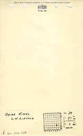
Louis L. Liptak
|
| Mine Name:
|
Liptak Mine
|
| Start Date:
|
1902
|
End Date:
|
1923
|
| Type of Mine:
|
Underground
|
| Total acres shown:
|
8
|
| Acres after map date:
|
|
General Area of mining acres shown:
|
|
|
|
Shaft, Slope, Drift or Tipple Location(s)
| Type
|
County
|
Township-Range
|
Section
|
Part Section
|
| Main shaft
|
La Salle
|
31N 3E
|
34
|
SW NE SE
|
Geology
Geological Problems Reported
Production
| Company
|
Mine Name
|
Date
|
Production (tons)
|
Production Notes
Coal Report production (if available)
Sources of Data
| Coal Section files
|
Undated
|
1:62500No source map of the mine was found. The mine outline and opening were hand-sketched and named on a Coal Section file copy of a USGS 15-minute topographic map.
|
1:62500
|
Secondary source
|
Annotated Bibliography (Data source - brief description of information)
| Coal Reports - Production, ownership, years of operation, mine type, depth, thickness, mining method.
|
| Directory of Illinois Coal Mines (La Salle County) - Mine names, mine index, ownership, years of operation.
|
| Coal Section files, USGS 15-minute topographic map - Shaft location, mine outline.
|
Mine Notes
Mine Images
Photographs