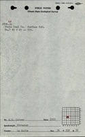
Mine Index Number: 2632
| Company Name:
|
Donkin Stobs Coal Company
|
| Mine Name:
|
Stobs Mine
|
| Start Date:
|
1908
|
End Date:
|
1924
|
| Type of Mine:
|
Underground
|
| Total acres shown:
|
13
|
| Production Indicated Acres:
|
20This production also covers Stobs Mine (mine index 5686) in SE 36-T31N-R3E.
|
General Area of mining acres shown:
|
|
|
|
Shaft, Slope, Drift or Tipple Location(s)
| Type
|
County
|
Township-Range
|
Section
|
Part Section
|
| Main slope
|
La Salle
|
31N 3E
|
36
|
NW NE SW
|
| Air shaft
|
La Salle
|
31N 3E
|
36
|
NW NE SW
|
Geology
Geological Problems Reported
Production
| Company
|
Mine Name
|
Date
|
Production (tons)
|
Production Notes
Coal Report production (if available)
Sources of Data
| Microfilm, mines06f.tif
|
2-1914
|
1:720
|
1:756
|
Secondary source
|
Annotated Bibliography (Data source - brief description of information)
| Coal Reports - Production, ownership, years of operation, mine type, depth.
|
| Directory of Illinois Coal Mines (La Salle County) - Mine names, mine index, ownership, years of operation.
|
| Mine notes (La Salle County) - Mine type, slope location, thickness.
|
| Microfilm map, Coal Section files, mines06f.tif - Slope and shaft locations, mine outline, mining method.
|
Mine Notes
Mine Images
Photographs