Mine Index Number: 2634
| Company Name:
|
Streator Coal Company
|
| Mine Name:
|
Streator No. 1 Mine
|
| Start Date:
|
Before 1876
|
End Date:
|
1884
|
| Type of Mine:
|
Underground
|
| Total acres shown:
|
137
|
| Acres after map date:
|
|
General Area of mining acres shown:
|
|
|
|
Shaft, Slope, Drift or Tipple Location(s)
| Type
|
County
|
Township-Range
|
Section
|
Part Section
|
| Main shaft
|
La Salle
|
31N 3E
|
36
|
NE NE SE
|
Geology
Geological Problems Reported
Production
| Company
|
Mine Name
|
Date
|
Production (tons)
|
| Streator Coal Company
|
Streator No. 1 (Old No. 4)
|
pre1876-1884The 1882 Coal Report indicated 54 acres had been mined. Production, ownership and years of operation before July 1881 are unknown. Production was listed under the No. 1 name in the Coal Reports, but the mine is shown on maps (including the 1876 Atlas of La Salle County) as the No. 4 Mine.
|
171,873
|
|
|
|
|
|
|
|
| Total Production: 171,873
|
Production Notes
Coal Report production (if available)
Sources of Data
| Microfilm, document 352327
|
1-1913
|
1:1200
|
1:2234
|
Secondary source
|
| Microfilm, mines087.tif and mines088.tif
|
Undated
|
Unknown
|
1:4248
|
Secondary source
|
| Microfilm, mines079.tif
|
1-22-1914
|
1:1200
|
1:1440
|
Secondary source
|
| Microfilm, mines099.tif and mines09b.tif
|
Undated
|
Unknown
|
1:3960
|
Secondary source
|
| Microfilm, mines066.tif and mines069.tif
|
Undated
|
1:1200
|
1:2076
|
Secondary source
|
| ISGS map library, 4103.L32 i5.1-23
|
Undated
|
1:12069
|
1:12069
|
Secondary source
|
Annotated Bibliography (Data source - brief description of information)
| Coal Reports - Production, ownership, years of operation, depth, thickness, mining method, geologic problems.
|
| Directory of Illinois Coal Mines (La Salle County) - Mine names, mine index, ownership, years of operation.
|
| Mine notes (La Salle County) - Shaft location.
|
| Microfilm map, document 352327, reel 03139, frame 433, map of Harrison Mine (mine index 2646) - Mine outline (eastern side), mining method.
|
| Microfilm map, Coal Section files, mines087.tif and mines088.tif - Mine outline (northern part).
|
| Microfilm map, Coal Section files, mines079.tif, map of Acme Mine (mine index 754) - Mine outline (partial of northern portion).
|
| Microfilm map, Coal Section files, mines099.tif & mines09b.tif - Mine outline (southern & eastern parts).
|
| Microfilm map, Coal Section files, mines066.tif & mines 069.tif, map of Stobs Mine (mine index 5686) - Mine outline (western part).
|
| ISGS map library, 4103.L32 i5.1-23, map of Streator Coal Field - Shaft location.
|
| Warner and Beers, 1876, Atlas of La Salle County, Illinois, Chicago, Illinois - Operating date (early).
|
Mine Notes
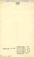
Mine Images
Photographs