Mine Index Number: 2640
| Company Name:
|
W. H. Munts Coal Company
|
| Mine Name:
|
Munts Mine
|
| Start Date:
|
1934
|
End Date:
|
1938
|
| Type of Mine:
|
Underground
|
| Total acres shown:
|
3
|
| Production Indicated Acres:
|
1
|
General Area of mining acres shown:
|
|
|
|
Shaft, Slope, Drift or Tipple Location(s)
| Type
|
County
|
Township-Range
|
Section
|
Part Section
|
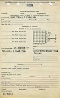
| Main shaft
|
La Salle
|
31N 3E
|
36
|
NW NW SE
|
| Air shaft
|
La Salle
|
31N 3E
|
36
|
SW NW SE
|
Geology
Geological Problems Reported
Production
| Company
|
Mine Name
|
Date
|
Production (tons)
|
Production Notes
Coal Report production (if available)
Sources of Data
| Microfilm, document 352420
|
8-7-1936
|
1:600
|
1:720
|
Not final
|
Annotated Bibliography (Data source - brief description of information)
| Coal Reports - Production, ownership, years of operation.
|
| Directory of Illinois Coal Mines (La Salle County) - Mine names, mine index, ownership, years of operation.
|
| Microfilm map, document 352420, reel 03139, frame 93 - Shaft locations, mine outline, mining method.
|
Mine Notes
Mine Images
Photographs