Mine Index Number: 3002
| Company Name:
|
Litchfield Mining and Manufacturing Company
|
| Mine Name:
|
Litchfield Mine
|
| Start Date:
|
1869
|
End Date:
|
1899
|
| Type of Mine:
|
Underground
|
| Total acres shown:
|
|
| Acres after map date:
|
|
General Area of mining acres shown:
|
191
|
|
The area shown is larger than reported production and area mined indicates. The known production of this mine indicates about 65 acres were mined; production prior to 1881 is unknown, but the 1883 Coal Report indicated 20 acres had been mined.
|
Shaft, Slope, Drift or Tipple Location(s)
| Type
|
County
|
Township-Range
|
Section
|
Part Section
|
| Shaft The mine notes indicate the third shaft was in operation in 1897. This later shaft is probably one of those shown;the location of one of the earlier shafts is unknown.
|
Montgomery
|
8N 5W
|
3
|
NW NW NW
|
| Shaft The mine notes indicate the third shaft was in operation in 1897. This later shaft is probably one of those shown;the location of one of the earlier shafts is unknown.
|
Montgomery
|
8N 5W
|
3
|
NE NW NW
|
Geology
| Survant (formerly Lowell)
|
500-520
|
|
|
3.5-4.0
|
LWSome HER was performed 1883-1885, preparatory to abandoning the mine. By changing to longwall miningmethod under Richardson, the mine stayed open. The older part of the mine was RP.
|
Geological Problems Reported
Production
| Company
|
Mine Name
|
Date
|
Production (tons)
|
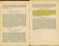
| Litchfield Coal Company According to The History of Montgomery County, this shaft was sunk in late 1869 and the second shaft was sunk in 1878. The mine notes indicate that Amalgamated Coal and Timber Company operated this mine sometime during this period.
|
Litchfield
|
1869-1882
|
unknown
|
|
|
|
|
|
|
|
| Total Production: 217,021.3
|
Production Notes
Coal Report production (if available)
Sources of Data
| Federal Land Bank Report
|
3-1934
|
1:49082
|
1:49082
|
Secondary source
|
Annotated Bibliography (Data source - brief description of information)
| Coal Reports - Production, ownership, years of operation, mine type, depth, thickness.
|
| Directory of Illinois Coal Mines (Montgomery County) - Mine names, mine index, ownership, years of operation.
|
| Mine notes (Montgomery County) - Shaft locations, seam.
|
| Federal Land Bank Report (Montgomery County) - General area of mining, shaft locations.
|
| Bateman, Newton and Paul Selby, editors, 1918, Historical Encyclopedia of Illinois and History of Montgomery County, Volume II: Munsell Publishing Company, Chicago, Illinois, 1195p. - Mine ownership, years of operation.
|
Mine Notes
Mine Images
Photographs


