Mine Index Number: 3152
| Company Name:
|
Unknown
|
| Mine Name:
|
Unknown Mine
|
| Start Date:
|
Unknown
|
End Date:
|
Before 1930
|
| Type of Mine:
|
Underground
|
| Total acres shown:
|
|
| Acres after map date:
|
|
General Area of mining acres shown:
|
|
|
|
Shaft, Slope, Drift or Tipple Location(s)
| Type
|
County
|
Township-Range
|
Section
|
Part Section
|
| Drift
|
Washington
|
2S 5W
|
25
|
NE NW NE
|
Geology
Geological Problems Reported
Production
| Company
|
Mine Name
|
Date
|
Production (tons)
|
Production Notes
Coal Report production (if available)
Sources of Data
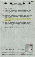
| ISGS field notes (F. T. Thwaites, 7-4-1930)
|
7-4-1930
|
1:62500
|
1:24000
|
Secondary source
|
Annotated Bibliography (Data source - brief description of information)
| ISGS field notes (Washington County) - Mine location, general time of mining ("many years ago").
|
Mine Notes
Mine Images
Photographs