Mine Index Number: 3516
| Company Name:
|
Fullerton Coal Company
|
| Mine Name:
|
Fullerton No. 1 Mine
|
| Start Date:
|
1889
|
End Date:
|
1940
|
| Type of Mine:
|
Underground
|
| Total acres shown:
|
195
|
| Acres after map date:
|
Less than 1
|
General Area of mining acres shown:
|
|
|
A general area of mining has been added to indicate the probable location and extent of the oldest mining, which was not shown on the source map.
|
Shaft, Slope, Drift or Tipple Location(s)
| Type
|
County
|
Township-Range
|
Section
|
Part Section
|
| Main shaft
|
St. Clair
|
1N 8W
|
16
|
NW NW NE
|
| Air shaft
|
St. Clair
|
1N 8W
|
16
|
NW NW NE
|
Geology
Geological Problems Reported
Production
| Company
|
Mine Name
|
Date
|
Production (tons)
|
|
|
|
|
|
| Total Production: 1,691,041
|
Production Notes
Coal Report production (if available)
Sources of Data
| Microfilm, document 351035
|
11-14-1939
|
1:2400
|
1:3972
|
Not final
|
| Microfilm, document 351022
|
circa 1935-1940
|
1:12000
|
1:24828
|
Secondary source
|
Annotated Bibliography (Data source - brief description of information)
| Coal Reports - Production, ownership, years of operation.
|
| Directory of Illinois Coal Mines (St. Clair County) - Mine names, mine index, ownership, years of operation.
|
| Mine notes (St. Clair County) - Shaft location, mine type, seam, depth, thickness.
|
| Microfilm map, document 351035, reel 03134, frame 120 - Shaft locations, mine outline, mining method.
|
| Microfilm map, document 351022, reel 03134, frame 101, WPA map of T1N-R8W - Mine outline (southwestern).
|
Mine Notes
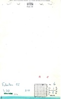
Mine Images
WPA: 351022
Map Date: circa 1935-1940
Coal Co.: Fullerton Coal Company
Mine Name: Fullerton No. 1
Full Res Download
Microfilm: 351035
Map Date: 11-14-1939
Coal Co.: Fullerton Coal Company
Mine Name: Fullerton No. 1
Full Res Download
Photographs