Mine Index Number: 3599
| Company Name:
|
John Carroll
|
| Mine Name:
|
Vancourt Mine
|
| Start Date:
|
Pre 1874
|
End Date:
|
1890
|
| Type of Mine:
|
Underground
|
| Total acres shown:
|
50
|
| Acres after map date:
|
5
|
General Area of mining acres shown:
|
|
|
|
Shaft, Slope, Drift or Tipple Location(s)
| Type
|
County
|
Township-Range
|
Section
|
Part Section
|
| Main shaft
|
St. Clair
|
2N 7W
|
29
|
NE NE SE
|
| Air shaft
|
St. Clair
|
2N 7W
|
29
|
SE NE SE
|
Geology
Geological Problems Reported
Production
| Company
|
Mine Name
|
Date
|
Production (tons)
|
| Vancourt Mining Company
|
Vancourt
|
pre1874-1884
|
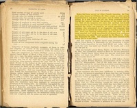
7,850 Idle 1882. Production prior to 1882 is unknown. The Coal Report of 1883 indicates 40 acres were mined. The 1874 Atlas of St. Clair County shows a shaft at this location, indicating mining was taking place in the early 1870s.
|
|
|
Production Notes
Coal Report production (if available)
Sources of Data
| Microfilm, document 350988
|
2-15-1887
|
1:1200
|
1:1986
|
Not final
|
Annotated Bibliography (Data source - brief description of information)
| Coal Reports - Production, ownership, years of operation.
|
| Directory of Illinois Coal Mines (St. Clair County) - Mine names, mine index, ownership, years of operation.
|
| Mine notes (St. Clair County) - Thickness, depth, seam, mine type, shaft location.
|
| Microfilm map, document 350988, reel 03134, frame 56 - Shaft locations, mine outline, mining method.
|
Mine Notes
Mine Images
Microfilm: 350988
Map Date: 2-15-1887
Coal Co.: John Carroll
Mine Name: Vancourt
Full Res Download
Photographs