Mine Index Number: 4313
| Company Name:
|
McKinley Coal Company
|
| Mine Name:
|
Summerfield Mine
|
| Start Date:
|
1887
|
End Date:
|
1890
|
| Type of Mine:
|
Underground
|
| Total acres shown:
|
11
|
| Acres after map date:
|
2
|
General Area of mining acres shown:
|
|
|
|
Shaft, Slope, Drift or Tipple Location(s)
| Type
|
County
|
Township-Range
|
Section
|
Part Section
|
| Main shaft
|
St. Clair
|
2N 6W
|
22
|
SW SE SE
|
| Air/escapement shaft
|
St. Clair
|
2N 6W
|
22
|
SW SE SE
|
Geology
Geological Problems Reported
Production
| Company
|
Mine Name
|
Date
|
Production (tons)
|
Production Notes
Coal Report production (if available)
Sources of Data
| Microfilm, document 351058
|
3-15-1889
|
1:1800
|
1:2731
|
Not final
|
Annotated Bibliography (Data source - brief description of information)
| Coal Reports - Production, ownership, years of operation, depth.
|
| Directory of Illinois Coal Mines (St. Clair County) - Mine names, mine index, ownership, years of operation.
|
| Microfilm map, document 351058, reel 03134, frame 156 - Shaft locations, mine outline, mining method.
|
Mine Notes
Mine Images
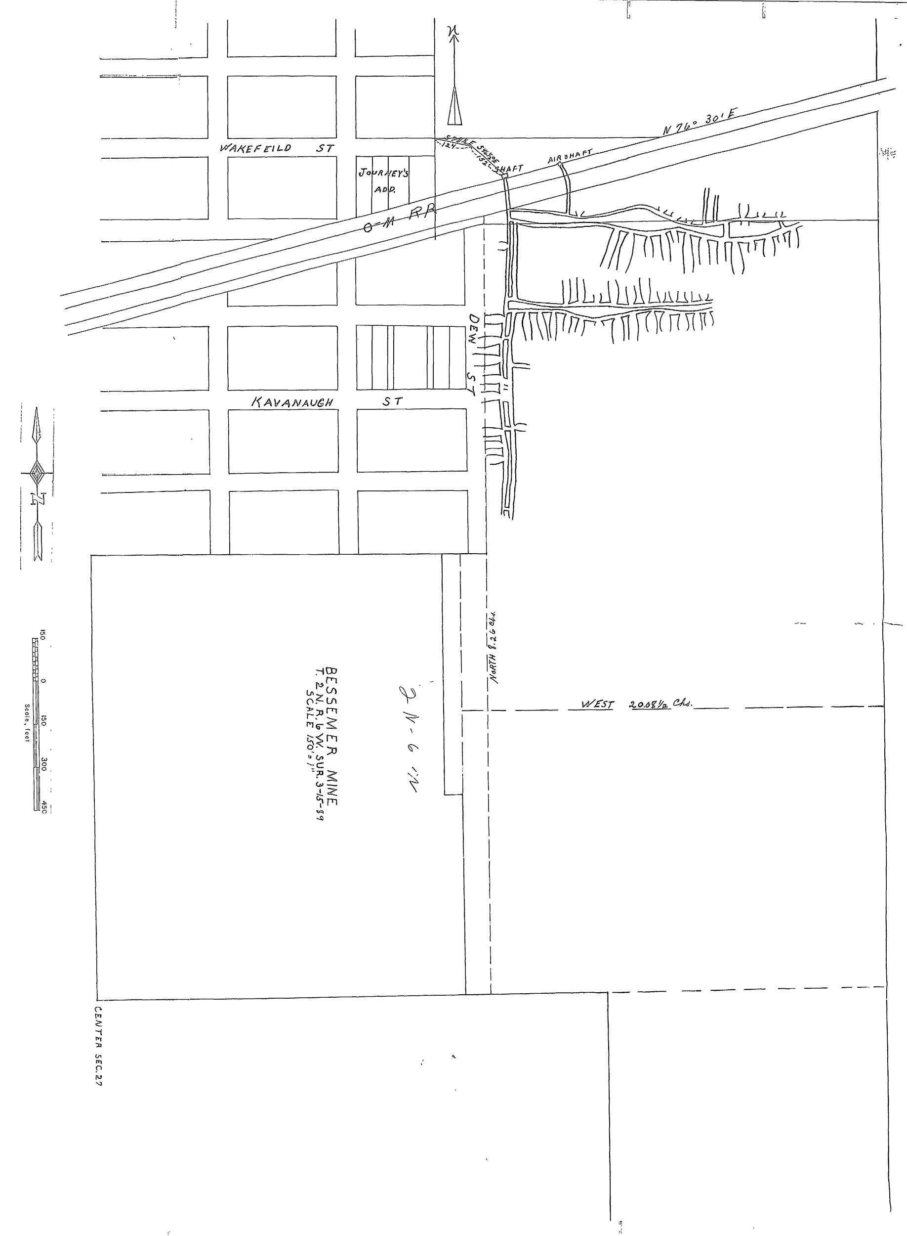 These files may not be true to scale and are not georgistered. These files may not be true to scale and are not georgistered.
|
Map Type:
|
Microfilm
|
| Map ID:
|
351058
|
| Company:
|
Bessemer Coal Company
|
| Mine Name:
|
|
| Caption:
|
|
| Map Date:
|
3-15-1889
|
| Map Status:
|
Not final
|
| Image Credit:
|
|
| Note:
|
|
| More Info:
|
M4313
|
| Full Res Download:These files are true to scale and most are georegistered for gis software. These files may be a very large (>1GB) download!
|
https://wikiimage.isgs.illinois.edu/ilmines/st clair/m4313.zip
|
Photographs