Mine Index Number: 4629
| Company Name:
|
Coy Rodgers Coal Company
|
| Mine Name:
|
Rodgers Mine
|
| Start Date:
|
1938
|
End Date:
|
1943
|
| Type of Mine:
|
Underground
|
| Total acres shown:
|
Less than 1 acre
|
| Acres after map date:
|
Less than 1
|
General Area of mining acres shown:
|
|
|
Not Shown On Map. Not shown on accompanying map because of later surface-mining by the Will Scarlet Mine (mine index 0697).
|
Shaft, Slope, Drift or Tipple Location(s)
| Type
|
County
|
Township-Range
|
Section
|
Part Section
|
| Main slope
|
Williamson
|
10S 4E
|
13
|
NW SW SW
|
| Air shaft The 1939 version of the source map shows an air shaft under construction west of the mine. On the 1942 source map, that air shaft is labeled “abandoned” and another air shaft was constructed south of the mine, in line with southward advancement of the mining.
|
Williamson
|
10S 4E
|
13
|
NW SW SW
|
Geology
Geological Problems Reported
Production
| Company
|
Mine Name
|
Date
|
Production (tons)
|
Production Notes
Coal Report production (if available)
Sources of Data
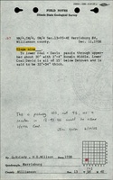
| Microfilm, document 353172
|
8-21-1942
|
1:1200
|
1:1406
|
Not final
|
Annotated Bibliography (Data source - brief description of information)
| Coal Reports - Production, ownership, years of operation, mining method.
|
| Directory of Illinois Coal Mines (Williamson County) - Mine names, mine index, ownership, years of operation.
|
| ISGS field notes (Williamson County) - Mine type, slope location, seam, thickness.
|
| Microfilm map, document 353172, reel 03142, frames 59, 60 - Slope and shaft locations, mine outline, mining method.
|
Mine Notes
Mine Images
Photographs