Mine Index Number: 6391
| Company Name:
|
Fulton and Harris
|
| Mine Name:
|
Fulton and Harris Mine
|
| Start Date:
|
Circa 1930
|
End Date:
|
Circa 1930
|
| Type of Mine:
|
Underground
|
| Total acres shown:
|
None
|
| Acres after map date:
|
|
General Area of mining acres shown:
|
|
|
|
Shaft, Slope, Drift or Tipple Location(s)
| Type
|
County
|
Township-Range
|
Section
|
Part Section
|
| Main shaft
|
Scott
|
13N 11W
|
21
|
NE NW SW
|
Geology
| Colchester
|
60-70
|
|
|
1.17
|
Underground
|
Geological Problems Reported
Production
| Company
|
Mine Name
|
Date
|
Production (tons)
|
Production Notes
Abandoned shortly after coal was encountered with no production.
Coal Report production (if available)
Sources of Data
| Mine notes (J. A. Harrison)
|
1941
|
1:62500
|
1:62500
|
Secondary source
|
Annotated Bibliography (Data source - brief description of information)
| Mine notes (Scott County) - Mine type, location, depth, thickness, years of operation (approximate).
|
Mine Notes
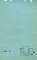
Mine Images
Photographs