Mine Index Number: 7815
| Company Name:
|
Alphonse Vermeulen
|
| Mine Name:
|
Vermeulen Mine
|
| Start Date:
|
circa 1923
|
End Date:
|
Unknown
|
| Type of Mine:
|
Underground
|
| Total acres shown:
|
Less than 1
|
| Acres after map date:
|
|
General Area of mining acres shown:
|
|
|
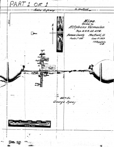
The mine’s location was based on the road and the source map indicating that the 40 acres where the mine was located was owned by George Sprague. A 1908 plat book shows NE NE & SE NE 27-T16N-R6E was owned by George Sprague. The “public highway to Sheffield” in the northern part of the map locates the mine N-S very well, but there is little in the E-W direction to accurately place the mine. The positional accuracy of shafts and the mine outline are therefore poor, and cannot be located more accurately than the 40-acre quarter of Section 27.
|
Shaft, Slope, Drift or Tipple Location(s)
| Type
|
County
|
Township-Range
|
Section
|
Part Section
|
| Shaft
|
Bureau
|
16N 6E
|
27
|
NE NE The mine’s location was based on the road and the source map indicating that the 40 acres where the mine was located was owned by George Sprague. A 1908 plat book shows NE NE & SE NE 27-T16N-R6E was owned by George Sprague. The “public highway to Sheffield” in the northern part of the map locates the mine N-S very well, but there is little in the E-W direction to accurately place the mine. The positional accuracy of shafts and the mine outline are therefore poor, and cannot be located more accurately than the 40-acre quarter of Section 27.
|
| Air shaft
|
Bureau
|
16N 6E
|
27
|
NE NE
|
Geology
Geological Problems Reported
Production
| Company
|
Mine Name
|
Date
|
Production (tons)
|
| Alphonse Vermeulen
|
Vermeulen
|
circa 1923
|
Unknown The Coal Reports listed Alphonse Vermeulen only once per year from 1919-1925. The production has been included with mine index 2033, as there are mine notes of a visit to the mine in that location where ISGS personnel had spoken to Mr. Vermeulen. It is just as likely that the production listed for mine index 2033 rightly goes to this mine, and it is possible that the production included both mines.
|
|
|
Production Notes
Coal Report production (if available)
Sources of Data
| Microfilm, document 351375
|
6-17-1923
|
1:1200
|
1:1200
|
Not final
|
Annotated Bibliography (Data source - brief description of information)
| Microfilm map, document 351375, reel 03135, frame 413 - Shaft locations, mine outline, mining method.
|
| Federal Land Bank Report (Bureau County) - General mine location.
|
Mine Notes
Mine Images
Microfilm: 351375
Map Date: 6-17-1923
Coal Co.: Alphonse Vermeulen
Mine Name: Vermeulen Mine
Full Res Download
Photographs

