Category:New Berlin-Quadrangle
MINING IN THE NEW BERLIN QUADRANGLE
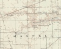
Previous mined-out area maps of the area included three mines. Subsequent research showed that all three mines were labeled with names of operators who worked one single mine, which ceased operation in 1941. The Cosmo Mine began operation in 1923 as Reynolds Coal Company. Confusion was initially caused by the very poor information on the Reynolds 1927 map, which had no ground surface information incorporated into the map, other than the 1/4-1/4 section written. In the past, the small map was placed at the center of the 40-acre area, and the point associated with that location has been deleted. Lebeter & Reynolds were succeeded by J. S. Williamson, and the 1933 map of Williamson Mine has an addition to the legend stating that ownership had changed to Cosmo Coal Corporation, with a later survey date (1941). An escape shaft was shown on the eastern side of the mine, and this was determined to be the old hoist shaft of Reynolds Mine with the aid of undated and un-attributed field notes. On the 1950 minedout area map, two rounded outlines appeared in 16-T14N-R7W, both labeled “Williamson Mine”. The outlines look like the map for the Federal Land Bank report, but with the mines shifted two miles east from Section 18 (into 16-T14N-R7W). As no field notes or mine notes verify a mine in Section 16, those two outlines were deleted.
Mines that Appear on the New Berlin Quadrangle
| Mine Index | Coal Company, Mine Name | County |
|---|---|---|
| 3338 | Reynolds Coal Company, Reynolds Mine J. S. Williamson, Williamson Mine Cosmo Coal Corporation, Cosmo Mine Glen Lebeter and J. Reynolds Company, Lebeter and Reynolds Mine | Sangamon |
Unlocated Mines in Sangamon County
| Mine Index | Coal Company, Mine Name | City |
|---|---|---|
| 3361 | W. H. Golloday, Golloday Mine N. C. Antle, Antle Mine Golladay and Brandt, Golladay and Brandt Mine Gordon and Duncan, Gordon and Duncan Mine John P. Gordon, Gordon Mine W. U. Whitehurst, Whitehurst Mine |
Media in category "New Berlin-Quadrangle"
The following 5 files are in this category, out of 5 total.
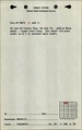 M3338 fieldnotes.pdf 750 × 1,193; 140 KB
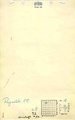 M3338 minenotes.pdf 733 × 1,175, 4 pages; 429 KB
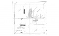 M3338a geo.jpg 3,398 × 2,088; 367 KB
 M3338b geo.jpg 2,754 × 3,398; 409 KB
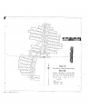
 M3338c.jpg 751 × 606; 148 KB


