File:C604 figure 010.jpg
Original file (1,700 × 2,200 pixels, file size: 312 KB, MIME type: image/jpeg)
| Mine Index(s): | Rose Creek Subdistrict, 10069406, 10083004, Rose Creek Subdistrict2 |
| ID Name/Number: | Figure 10 |
| File Type: | Figure |
| Mine Company: | |
| Mine Name | |
| Date | |
| Map Scale | |
| File Credit | Copyright © University of Illinois Board of Trustees |
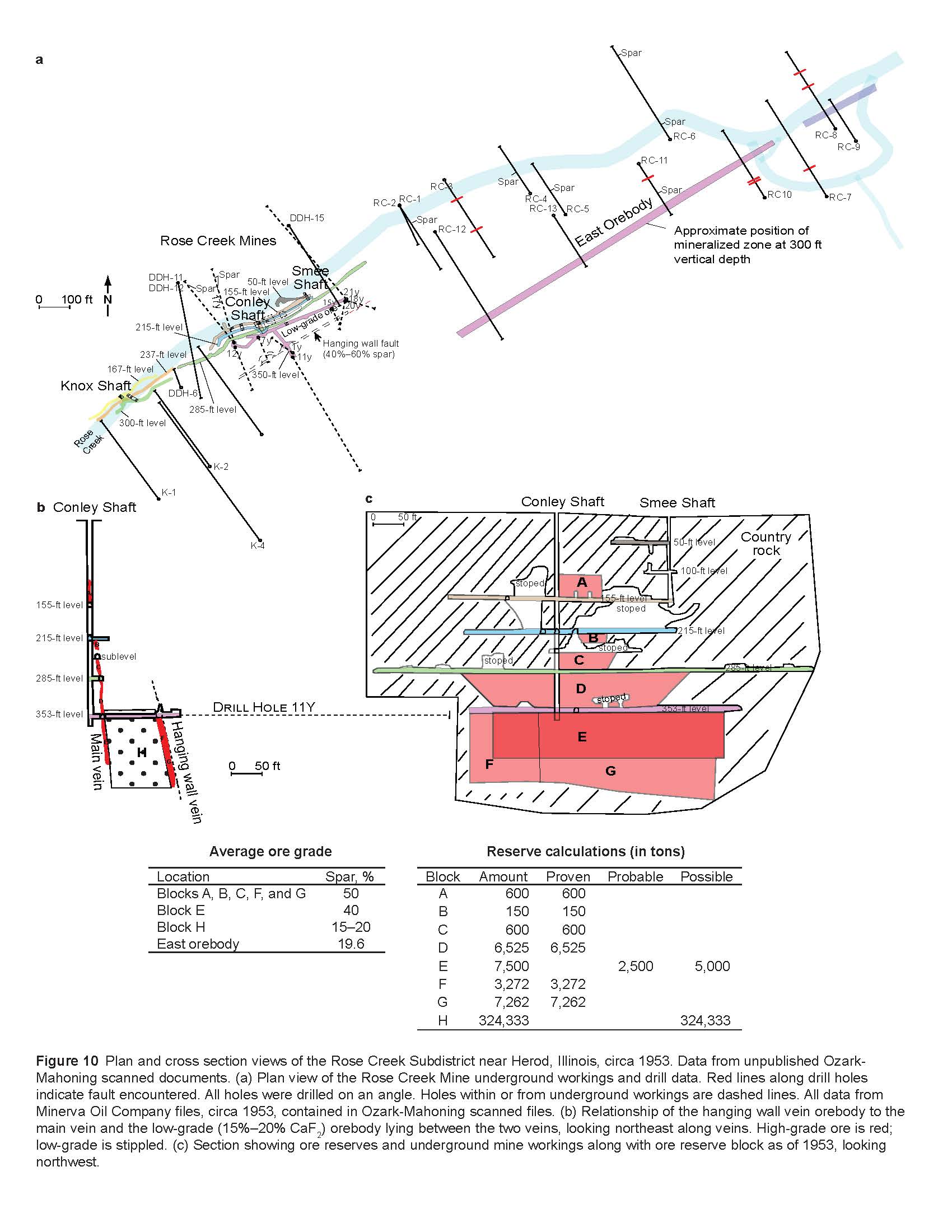
| Caption | Figure 10 Plan and cross section views of the Rose Creek Subdistrict near Herod, Illinois, circa 1953. Data from unpublished Ozark-
Mahoning scanned documents. |
| Publication | Circular 604 |
File history
Click on a date/time to view the file as it appeared at that time.
| Date/Time | Thumbnail | Dimensions | User | Comment | |
|---|---|---|---|---|---|
| current | 07:17, June 8, 2021 | | 1,700 × 2,200 (312 KB) | Alan.Myers (talk | contribs) |
You cannot overwrite this file.
File usage
The following 3 pages use this file: