File:Dantwp1895 Copy1.jpg

Size of this preview: 738 × 600 pixels. Other resolutions: 2,521 × 2,048 pixels | 3,390 × 2,754 pixels.
Original file (3,390 × 2,754 pixels, file size: 1.52 MB, MIME type: image/jpeg)
CLICK HERE TO DOWNLOAD THE HIGH RESOLUTION IMAGE. FILE SIZE MAY BE LARGE(Note:this file is usually better quality than "original file" linked above)
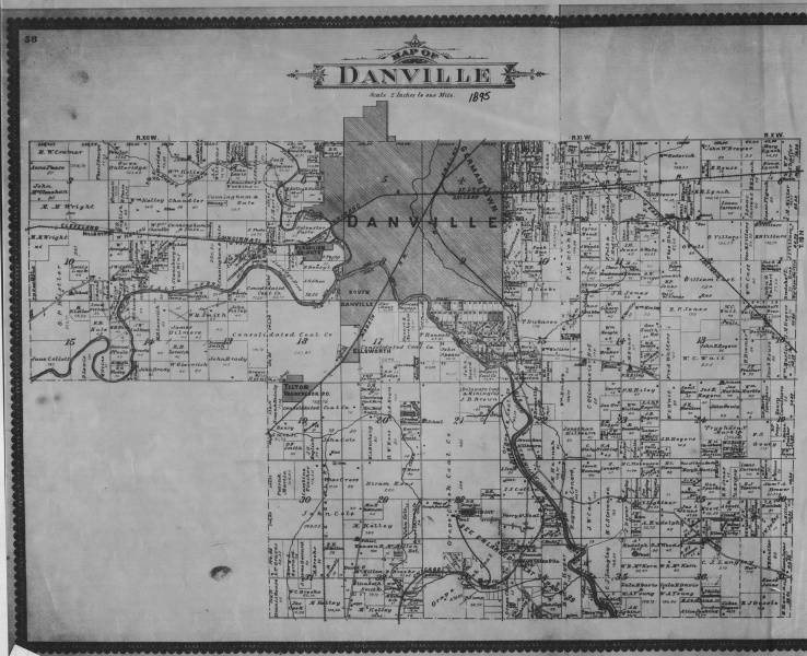
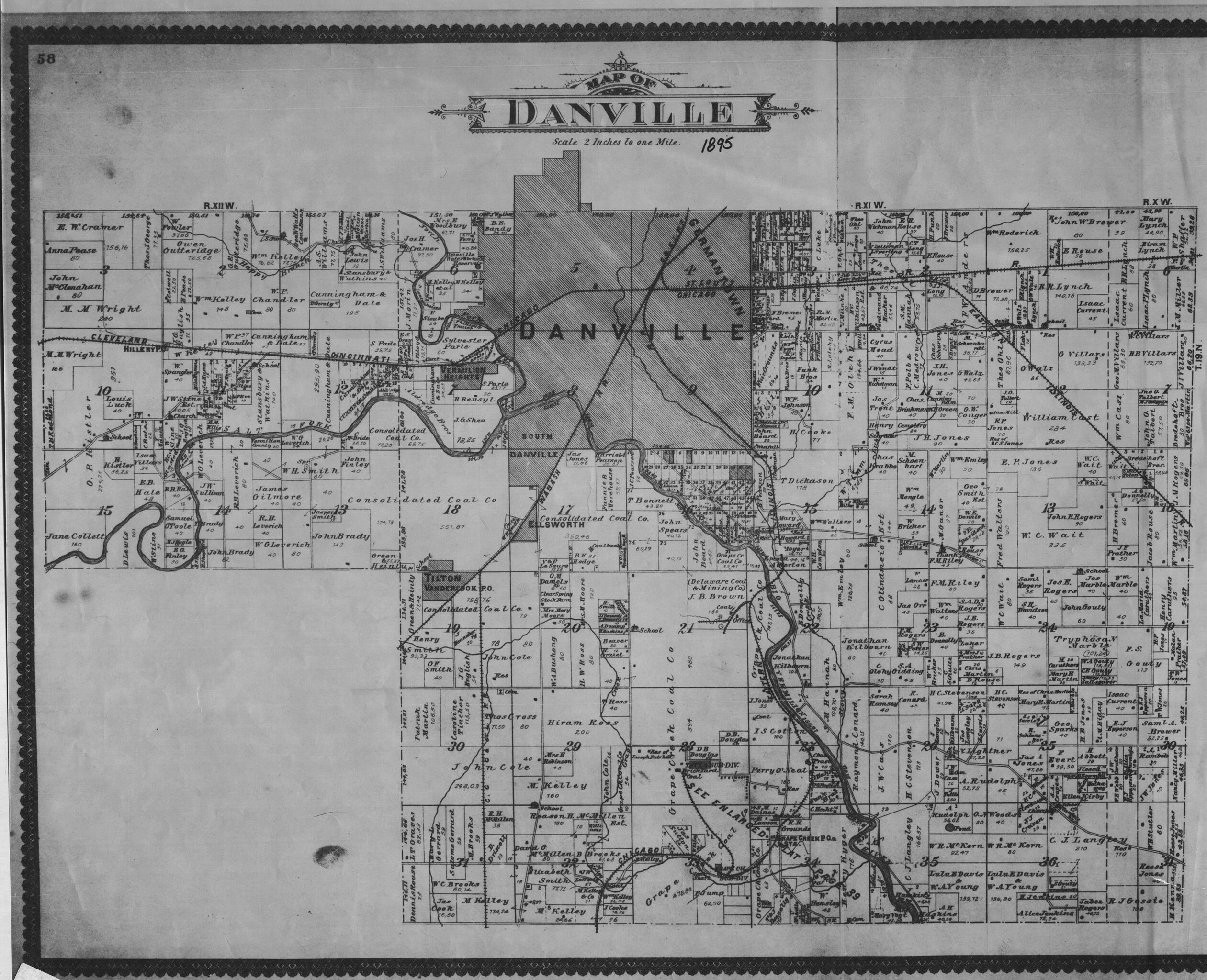
| Mine Index(s): | 3743, 6789,3743 |
| Mine Company: | I. S. Cotton |
| Mine Name | Cotton Mine |
| Map Date | 1895 |
| Map Scale | 1:2400 |
| Map Type microfilm/company/wpa/quade | Atlas |
| Map Status final,not final, secondary | Secondary source |
| ID Number | |
| Used For | Mine location, land owner (may not be mine operator). |
| Notes | Georegistration poor, map is more a generalized sketch than a map. Section corners don't match up, but used Geologist Friend to get quarter-quarter-quarter-section location and that location was plotted on USGS topographic map. |
| Image Credit | |
| Hi-Res Download | Click to download |
File history
Click on a date/time to view the file as it appeared at that time.
| Date/Time | Thumbnail | Dimensions | User | Comment | |
|---|---|---|---|---|---|
| current | 14:19, March 17, 2020 | | 3,390 × 2,754 (1.52 MB) | Cheri (talk | contribs) |
You cannot overwrite this file.