File:M0304 atlas1874.jpg
Size of this preview: 800 × 427 pixels. Other resolution: 1,857 × 992 pixels.
Original file (1,857 × 992 pixels, file size: 276 KB, MIME type: image/jpeg)
CLICK HERE TO DOWNLOAD THE HIGH RESOLUTION IMAGE. FILE SIZE MAY BE LARGE(Note:this file is usually better quality than "original file" linked above)
| Mine Index(s): | 0304, 3595,3595 |
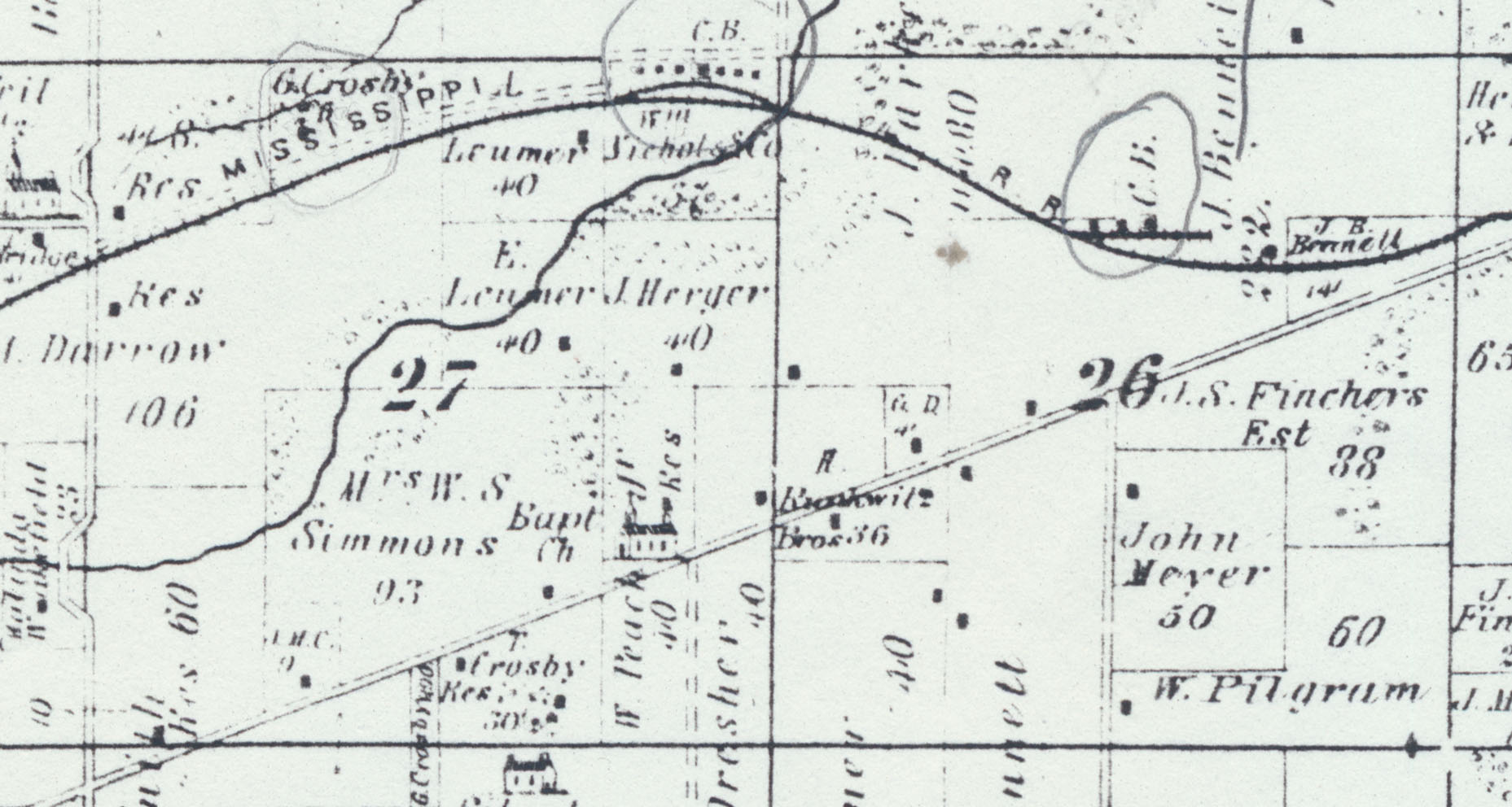
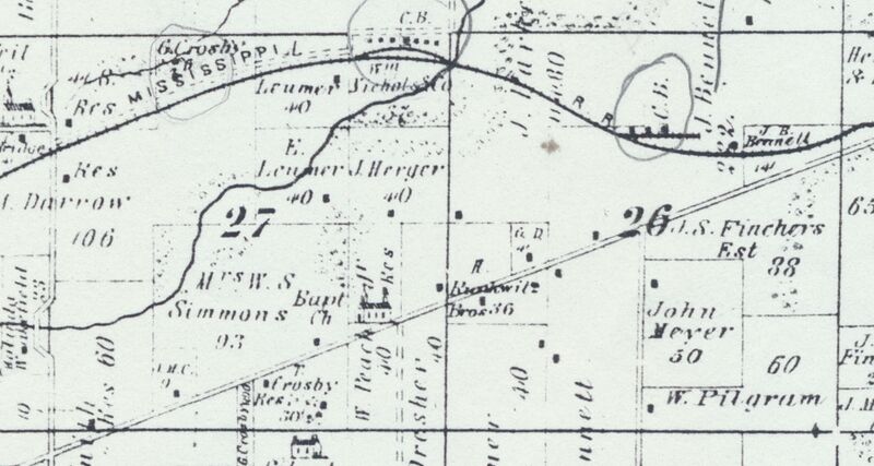
| Mine Company: | Jeremiah Bennett |
| Mine Name | Bennett Mine |
| Map Date | 1874 |
| Map Scale | 1:62500 |
| Map Type microfilm/company/wpa/quade | Atlas |
| Map Status final,not final, secondary | Secondary source |
| ID Number | |
| Used For | years of operation, mine locations |
| Notes | Warner & Beers, 1874, An Illustrated Historical Atlas of St. Clair County, IL, Warner & Beers Publishers, Chicago, Illinois, 115p. |
| Image Credit | |
| Hi-Res Download | Click to download |
File history
Click on a date/time to view the file as it appeared at that time.
| Date/Time | Thumbnail | Dimensions | User | Comment | |
|---|---|---|---|---|---|
| current | 17:19, August 27, 2021 | | 1,857 × 992 (276 KB) | Cheri (talk | contribs) |
You cannot overwrite this file.