File:M0694 new.jpg
Size of this preview: 414 × 599 pixels. Other resolution: 2,342 × 3,390 pixels.
Original file (2,342 × 3,390 pixels, file size: 1.61 MB, MIME type: image/jpeg)
CLICK HERE TO DOWNLOAD THE HIGH RESOLUTION IMAGE. FILE SIZE MAY BE LARGE(Note:this file is usually better quality than "original file" linked above)
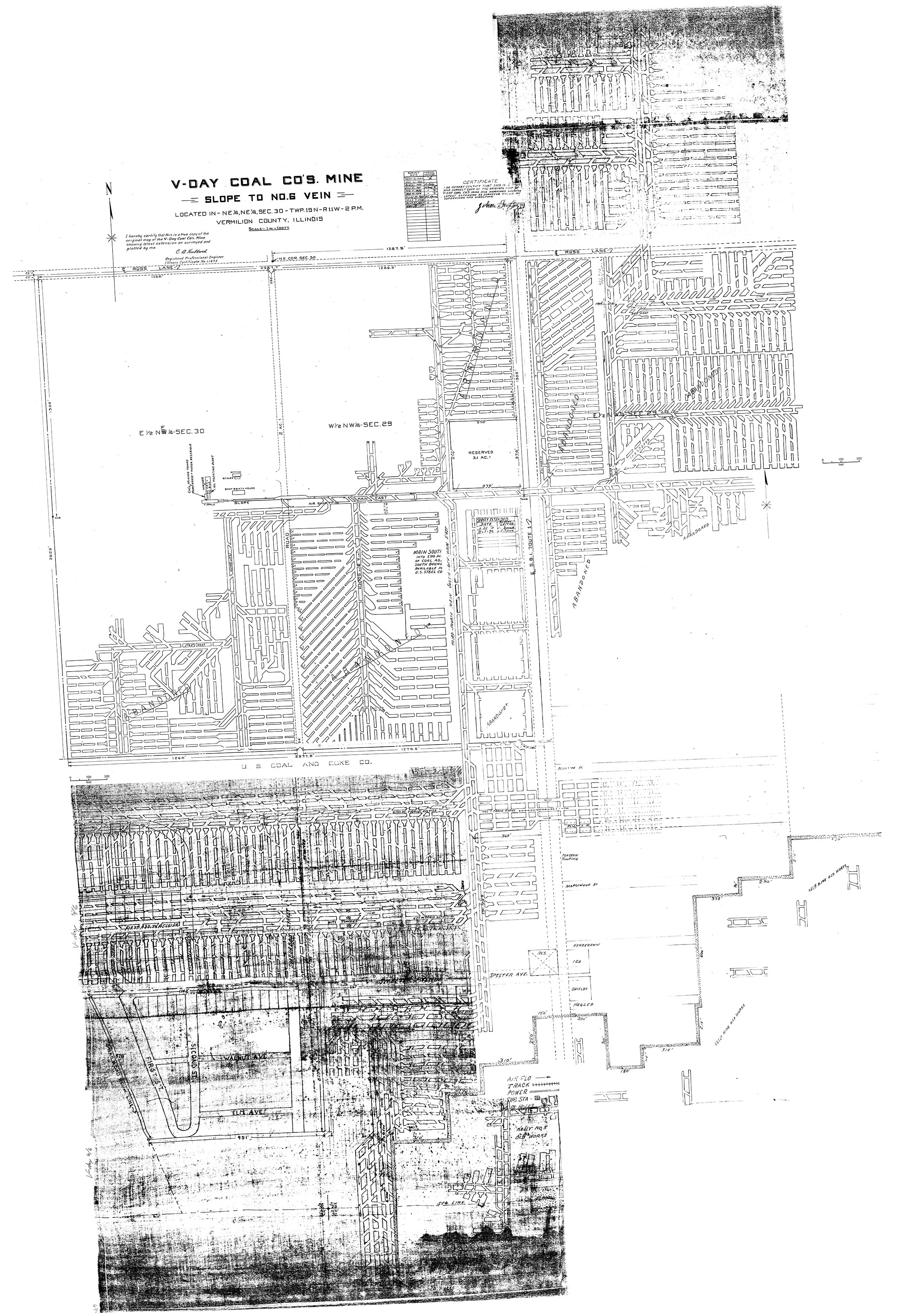
| Mine Index(s): | 0694 |
| Mine Company: | V-Day Coal Company |
| Mine Name | V-Day Mine |
| Map Date | 11-1-1970 |
| Map Scale | 1:1200 |
| Map Type microfilm/company/wpa/quade | Company |
| Map Status final,not final, secondary | Not final |
| ID Number | |
| Used For | mine outline, shaft locations, mining method |
| Notes | The map is a compilation of MSHA_939 (11-18-1957), MSHA_724 (11-1-1970), and a company map from the Vermilion County Recorder's Office, traced and stored in Coal Section files as 10-8-9 (1960 and 1969). |
| Image Credit | Illinois Department of Natural Resources - Office of Mines and Minerals |
| Hi-Res Download | Click to download |
File history
Click on a date/time to view the file as it appeared at that time.
| Date/Time | Thumbnail | Dimensions | User | Comment | |
|---|---|---|---|---|---|
| current | 11:16, March 19, 2021 | | 2,342 × 3,390 (1.61 MB) | Cheri (talk | contribs) |
You cannot overwrite this file.
File usage
The following page uses this file: