File:M0792 IL117.jpg
Size of this preview: 668 × 600 pixels. Other resolutions: 2,282 × 2,048 pixels | 3,390 × 3,043 pixels.
Original file (3,390 × 3,043 pixels, file size: 1.56 MB, MIME type: image/jpeg)
CLICK HERE TO DOWNLOAD THE HIGH RESOLUTION IMAGE. FILE SIZE MAY BE LARGE(Note:this file is usually better quality than "original file" linked above)
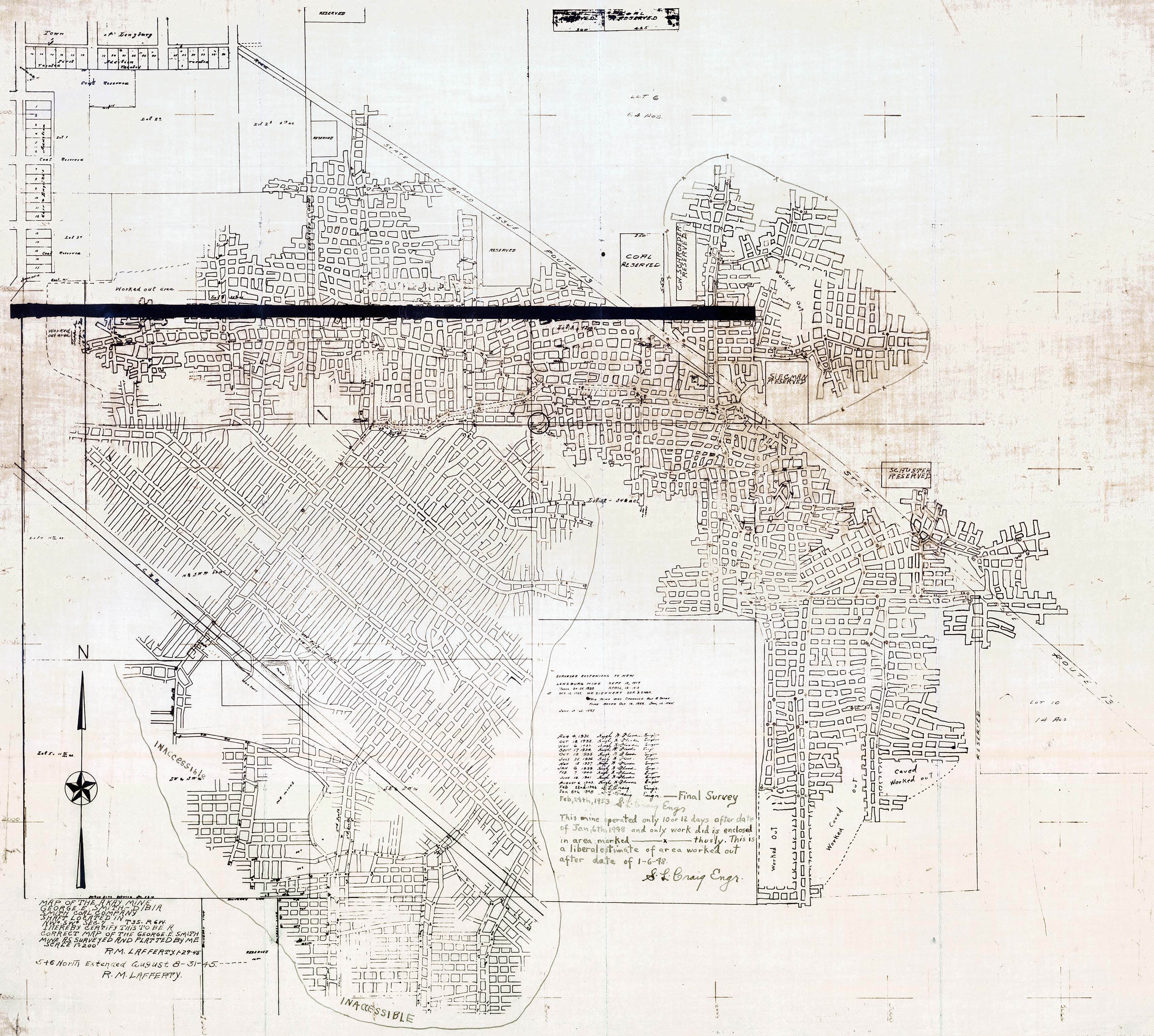
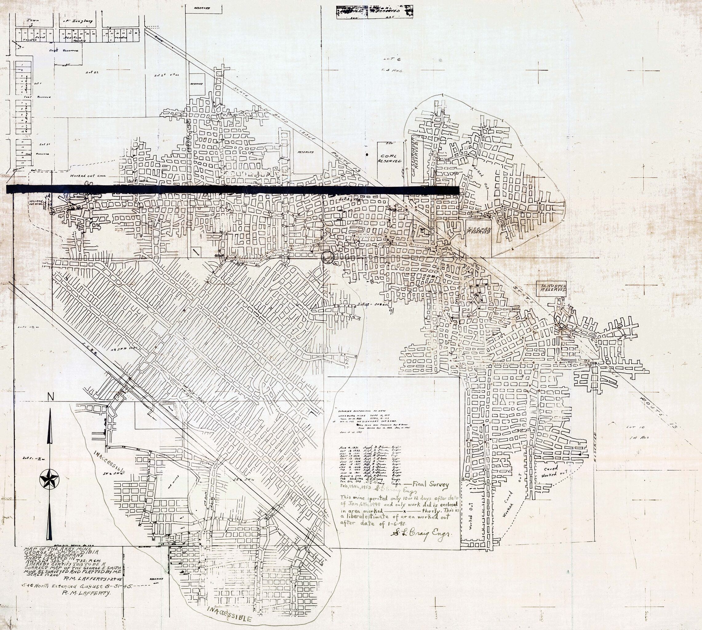
| Mine Index(s): | 0792 |
| Mine Company: | Senior Hill Coal Company |
| Mine Name | A-kay Mine |
| Map Date | 2-24-1953 |
| Map Scale | 1:2400 |
| Map Type microfilm/company/wpa/quade | State Archive |
| Map Status final,not final, secondary | Final |
| ID Number | IL_117 |
| Used For | shaft locations, mine outline, mining method, geologic problems |
| Notes | The map had to be warped to make the features fit the topographic map. There was nothing to measure to clearly scale the map correctly. |
| Image Credit | |
| Hi-Res Download | Click to download |
File history
Click on a date/time to view the file as it appeared at that time.
| Date/Time | Thumbnail | Dimensions | User | Comment | |
|---|---|---|---|---|---|
| current | 12:31, December 15, 2021 | | 3,390 × 3,043 (1.56 MB) | Cheri (talk | contribs) |
You cannot overwrite this file.
File usage
The following page uses this file: