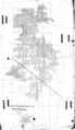
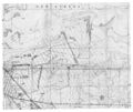
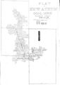
New Athens East Quadrangle
Mining in the New Athens East Quadrangle
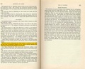
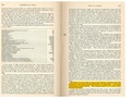
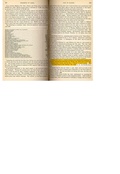
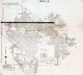
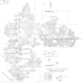
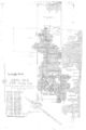
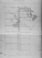
Mining in this quadrangle began prior to 1876, and continued until as late as 1992. The date of the earliest mining is not known; the 1876 mine outline (mine index 3537, New Athens Mine) indicates mining at least a couple of years prior to the map date. The most recent (and largest) mine contained within the New Athens East quadrangle is the River King Surface Mine, Pit No. 3 (mine index 0857), northeast of New Athens. Three of the mines in this area operated for long periods; the Vinegar Hill Mine (mine index 0650) operated for 48 years, the A-kay Mine (mine index 0792) operated for 55 years, and the Golden Rule Mine (mine index 0794) operated for 44 years.
The Herrin Coal was the major coal mined here, ranging from 6.0 to 7.0 feet thick and 28 to 100 feet deep. Several mines reported water, and a number of mines reported problems with the mine roof "caving". These problems typically occur in wet conditions such as this where the bedrock cover above the coal is relatively thin.
Map and Directory PDF Download
Coal Mines In Illinois New Athens East Quadrangle
Mines that Appear on the New Athens East Quadrangle
Unlocated Mines
St. Clair County
Pages in category "New Athens East Quadrangle"
The following 21 pages are in this category, out of 21 total.
Media in category "New Athens East Quadrangle"
The following 25 files are in this category, out of 25 total.
 M0308 coalreport1903 p292.pdf 1,525 × 1,229; 255 KB
 M0308 minenotes.pdf 737 × 1,183, 4 pages; 767 KB
 M0650 coalreport1900 p287.pdf 1,558 × 1,193; 351 KB
 M0650 coalreport1901 p239.pdf 1,308 × 1,168; 360 KB
 M0650 minenotes.pdf 737 × 1,183, 10 pages; 2.05 MB
 M0650mrg.jpg 1,886 × 3,254; 995 KB
 M0792 IL117.jpg 3,390 × 3,043; 1.56 MB
 M0792 minenotes.pdf 737 × 1,183, 7 pages; 1.34 MB
 M0794 minenotes.pdf 737 × 1,183, 5 pages; 1.09 MB
 M0794.jpg 3,338 × 3,390; 1.35 MB
 M0795 minenotes.pdf 737 × 1,183, 5 pages; 1.06 MB
 M0795.jpg 2,261 × 3,390; 927 KB
 M0856 minenotes.pdf 737 × 1,183, 17 pages; 3.72 MB
 M0857na.jpg 3,390 × 2,862; 1.74 MB
 M0934 minenotes.pdf 716 × 793, 55 pages; 5.7 MB
 M3617 minenotes.pdf 737 × 1,183, 4 pages; 828 KB
 M3617.jpg 2,400 × 3,390; 504 KB
 M3618 pb83.jpg 2,485 × 3,390; 589 KB
 M3619 minenotes.pdf 737 × 1,183, 6 pages; 1.45 MB
 M3620 coalreport1904 p316.pdf 1,647 × 1,229; 411 KB
 M3620 minenotes.pdf 737 × 1,183, 8 pages; 1.61 MB
 M3628 minenotes.pdf 737 × 1,183, 4 pages; 934 KB
 M3628.jpg 2,651 × 3,390; 1,015 KB
 M3628mrg.jpg 1,894 × 3,390; 340 KB
 M5277.jpg 3,306 × 3,390; 835 KB


