Mine Index Number: 3617
| Company Name:
|
New Athens Coal Company
|
| Mine Name:
|
New Athens Mine
|
| Start Date:
|
1906
|
End Date:
|
April 14, 1942
|
| Type of Mine:
|
Underground
|
| Total acres shown:
|
40
|
| Acres after map date:
|
|
General Area of mining acres shown:
|
|
|
Truncated area shown, post surface mining by Peabody Coal Company, River King Surface, Pit No. 3 (mine index 0857).
|
Shaft, Slope, Drift or Tipple Location(s)
| Type
|
County
|
Township-Range
|
Section
|
Part Section
|
| Main shaft
|
St. Clair
|
2S 7W
|
26
|
SE NW SW
|
| Air shaft
|
St. Clair
|
2S 7W
|
26
|
SE NW SW
|
Geology
| Herrin
|
80-85
|
6.5
|
7.0
|
6.75
|
MRP
|
Geological Problems Reported
Production
| Company
|
Mine Name
|
Date
|
Production (tons)
|
|
|
|
|
|
| Total Production: 230,587
|
Production Notes
Coal Report production (if available)
Sources of Data
| Company, 4103.S31 i5.1-14
|
4-14-1942
|
1:1200
|
1:1200
|
Final
|
Annotated Bibliography (Data source - brief description of information)
| Coal Reports - Production, ownership, years of operation.
|
| Directory of Illinois Coal Mines (St. Clair County) - Mine names, mine index, ownership, years of operation.
|
| Mine notes (St. Clair County) - Mine type, shaft location, seam, depth, thickness.
|
| Company map, ISGS map library, 4103.S31 i5.1-14 - Shaft locations, mine outline, mining method.
|
Mine Notes
Mine Images
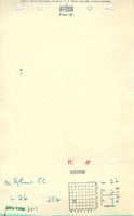
ISGS map library: 4103.S31 i5.1-14
Map Date: 4-14-1942
Coal Co.: New Athens Coal Company
Mine Name: New Athens Mine
Full Res Download
Photographs