Mine Index Number: 0650
| Company Name:
|
Okaw Coal Company
|
| Mine Name:
|
Vinegar Hill Mine
|
| Start Date:
|
1900
|
End Date:
|
July 1948
|
| Type of Mine:
|
Underground
|
| Total acres shown:
|
637
|
| Acres after map date:
|
|
General Area of mining acres shown:
|
|
|
The boundary between this mine and the Fairbanks Mine (mine index 0308) could not be distinguished. The acreage reported is the total for both mines.
|
Shaft, Slope, Drift or Tipple Location(s)
| Type
|
County
|
Township-Range
|
Section
|
Part Section
|
| Main shaft (7.5'x14')
|
St. Clair
|
3S 7W
|
2
|
SE NE NW
|
| Air shaft
|
St. Clair
|
3S 7W
|
2
|
SE NE NW
|
Geology
Geological Problems Reported
The mine map shows the northeastern and northwestern areas of the mine labeled “inaccessible”, the northeastern portion due to caving.
Production
| Company
|
Mine Name
|
Date
|
Production (tons)
|
|
|
|
|
|
| Total Production: 1,949,377
|
Production Notes
Coal Report production (if available)
Sources of Data
| Microfilm, document 351066
|
2-15-1949
|
1:2400
|
1:4469
|
Final
|
Annotated Bibliography (Data source - brief description of information)
| Coal Reports - Production, ownership, years of operation.
|
| Directory of Illinois Coal Mines (St. Clair County) - Mine names, mine index, ownership, years of operation.
|
| Mine notes (St. Clair County) - Mine type, shaft location, shaft size, seam, depth, thickness.
|
| Microfilm map, document 351066, reel 03134, frames 164-167 - Shaft locations, mine outline, mining method, geologic problems.
|
Mine Notes
Mine Images
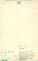
Microfilm: 351066
Map Date: 2-15-1949
Coal Co.: Okaw Coal Company
Mine Name: Vinegar Hill Mine
Full Res Download
Photographs