Mine Index Number: 3628
| Company Name:
|
Peabody Coal Company
|
| Mine Name:
|
Seminole Mine
|
| Start Date:
|
1949
|
End Date:
|
May 1960
|
| Type of Mine:
|
Surface
|
| Total acres shown:
|
1,003
|
| Acres after map date:
|
|
General Area of mining acres shown:
|
|
|
|
Shaft, Slope, Drift or Tipple Location(s)
| Type
|
County
|
Township-Range
|
Section
|
Part Section
|
| Tipple
|
St. Clair
|
3S 7W
|
11
|
SW SW NE
|
Geology
| Herrin
|
28-65
|
|
|
6.0-6.3
|
Surface
|
Geological Problems Reported
Production
| Company
|
Mine Name
|
Date
|
Production (tons)
|
|
|
|
|
|
| Total Production: 7,821,258
|
Production Notes
Coal Report production (if available)
Sources of Data
| Microfilm, document 351166
|
6-1-1954
|
1:1200
|
1:5628
|
Final Final for Pit 2 (stated on map)
|
| Company, 4103.S31 i5.1-63
|
3-14-1969
|
1:62500
|
1:62500
|
Final
|
Annotated Bibliography (Data source - brief description of information)
| Coal Reports - Production, ownership, years of operation, seam, depth, thickness.
|
| Directory of Illinois Coal Mines (St. Clair County) - Mine names, mine index, ownership, years of operation.
|
| Mine notes (St. Clair County) - Mine location, seam.
|
| Microfilm map, document 351166, reel 03134, frames 309-311 - Mine outline, mining method.
|
| Company map, ISGS map library, 4103.S31 i5.1-63 - Mine outline, mining method.
|
Mine Notes
Mine Images
ISGS map library: 4103.S31 i5.1-63 (sheets 1 & 2)
Map Date: 3-14-1969
Coal Co.: Peabody Coal Company
Mine Name: Seminole Mine
Full Res Download
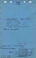
Microfilm: 351166
Map Date: 6-1-1954
Coal Co.: Peabody Coal Company
Mine Name: Seminole Mine
Full Res Download
Photographs