File:M0852.jpg

Size of this preview: 564 × 599 pixels. Other resolutions: 1,928 × 2,048 pixels | 3,191 × 3,390 pixels.
Original file (3,191 × 3,390 pixels, file size: 778 KB, MIME type: image/jpeg)
CLICK HERE TO DOWNLOAD THE HIGH RESOLUTION IMAGE. FILE SIZE MAY BE LARGE(Note:this file is usually better quality than "original file" linked above)
| Mine Index(s): | 0852 |
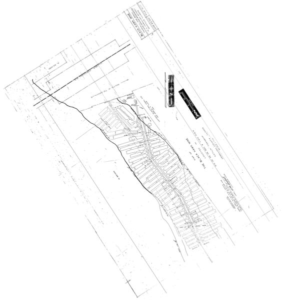
| Mine Company: | Black Hawk Coal Company |
| Mine Name | Black Hawk Mine |
| Map Date | 6-27-1941 |
| Map Scale | 1:600 |
| Map Type microfilm/company/wpa/quade | Microfilm |
| Map Status final,not final, secondary | Not final |
| ID Number | 352947 |
| Used For | slope and air shaft locations, mine outline, mining method |
| Notes | microfilm map, document 352947, reel 0314, frame 89; the map was difficult to geo-register, having almost no information to tie to the topographic map. The property line was aligned with the property line on Black Hawk No. 2 Mine (mine index 6757), along with the tipple used for both mines. It looks reasonable, but may not be located correctly. |
| Image Credit | |
| Hi-Res Download | Click to download |
File history
Click on a date/time to view the file as it appeared at that time.
| Date/Time | Thumbnail | Dimensions | User | Comment | |
|---|---|---|---|---|---|
| current | 14:28, March 19, 2021 | | 3,191 × 3,390 (778 KB) | Cheri (talk | contribs) |
You cannot overwrite this file.
File usage
The following page uses this file: