|
|
| Line 1: |
Line 1: |
| {{Sidebar Info Query}} | | {{Sidebar Info Query}} |
| {{Header | | {{Header |
| | |checked=Checked OK |
| |unlocated=No | | |unlocated=No |
| |shown_on_map=Yes | | |shown_on_map=Yes |
| Line 14: |
Line 15: |
| |Latitude=38.2308943530001 | | |Latitude=38.2308943530001 |
| |Longitude=-89.73157875 | | |Longitude=-89.73157875 |
| | |Zoom=15 |
| }} | | }} |
| ==Shaft, Slope, Drift or Tipple Location(s)== | | ==Shaft, Slope, Drift or Tipple Location(s)== |
Revision as of 17:51, December 6, 2021
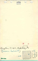
Mine Index Number: 3625
| Company Name:
|
Egyptian Coal and Mining Company
|
| Mine Name:
|
Oak Ridge Mine
|
| Start Date:
|
1882
|
End Date:
|
1912
|
| Type of Mine:
|
Underground
|
| Total acres shown:
|
243 The area shown on the accompanying map includes the area mined for White Oak No. 1 Mine (mine index 3627). The boundary between the two mines could not be discerned. According to the source maps, Oak Ridge Mine (White Oak No. 2 Mine) was generally north of the railroad, while White Oak No. 1 Mine was generally south of the railroad. With the area mined before reported production for White Oak No. 1 Mine, production indicates approximately 320 acres were mined.
|
| Acres after map date:
|
|
General Area of mining acres shown:
|
|
|
|
Shaft, Slope, Drift or Tipple Location(s)
| Type
|
County
|
Township-Range
|
Section
|
Part Section
|
| Main shaft (7.5 x 14 ft) No air shafts were shown on the source maps. It is likely that ventilation was provided by underground connection with White Oak No. 1 Mine (mine index 3627).
|
St. Clair
|
3S 6W
|
35
|
SW SE NE
|
Geology
| Herrin
|
156
|
5.5
|
7.5
|
6.5
|
RP
|
Geological Problems Reported
The roof was 6 inches to 2 feet of shale beneath 14 feet of limestone. Slips were common in the white top above the coal. The coal contained considerable pyrite. The underclay was generally 6 to 10 inches thick, but ranged from 3 inches to 4 feet.
Production
| Company
|
Mine Name
|
Date
|
Production (tons)
|
Production Notes
Coal Report production (if available)
Sources of Data
| Microfilm, document 351249
|
8-27-1920
|
1:2400
|
1:4634
|
Final
|
| Microfilm, document 351006
|
12-30-1885
|
1:1200
|
1:1075
|
Not final
|
Annotated Bibliography (Data source - brief description of information)
| Coal Reports - Production, ownership, years of operation, mining method.
|
| Directory of Illinois Coal Mines (St. Clair County) - Mine names, mine index, ownership, years of operation.
|
| Mine notes (St. Clair County) - Mine type, shaft location & size, seam, depth, thickness, geologic problems.
|
| Microfilm map, document 351249, reel 03134, frames 501 & 502 - Shaft location, mine outline, mining method.
|
| Microfilm map, document 351006, reel 03134, frame 76 - Shaft identification.
|
Mine Notes
Mine Images
![[[:Meeks No. 2|Meeks No. 2]]](https://wikiimage.isgs.illinois.edu/ilmines/st_clair/thumbnails/m0205_IL_122_01_th.jpg) These files may not be true to scale and are not georgistered. These files may not be true to scale and are not georgistered.
|
Map Type:
|
State Archive
|
| Map ID:
|
IL_122_01
|
| Company:
|
Egyptian Coal and Mining Company
|
| Mine Name:
|
Meeks No. 2
|
| Caption:
|
|
| Map Date:
|
08/27/1920
|
| Map Status:
|
Not Final
|
| Image Credit:
|
|
| Note:
|
Also used for the outline of mine indexes 3625/3627.
|
| More Info:
|
M0205 IL 122 01
|
| Full Res Download:These files are true to scale and most are georegistered for gis software. These files may be a very large (>1GB) download!
|
https://wikiimage.isgs.illinois.edu/ilmines/st clair/m0205 IL 122 01.zip
|
![[[:White Oak No. 2|White Oak No. 2]]](https://wikiimage.isgs.illinois.edu/ilmines/st_clair/thumbnails/m3625.jpg) These files may not be true to scale and are not georgistered. These files may not be true to scale and are not georgistered.
|
Map Type:
|
Microfilm
|
| Map ID:
|
351006 3134 76
|
| Company:
|
|
| Mine Name:
|
White Oak No. 2
|
| Caption:
|
|
| Map Date:
|
12/30/1885
|
| Map Status:
|
Not Final
|
| Image Credit:
|
|
| Note:
|
|
| More Info:
|
M3625
|
| Full Res Download:These files are true to scale and most are georegistered for gis software. These files may be a very large (>1GB) download!
|
https://wikiimage.isgs.illinois.edu/ilmines/st clair/m3625.zip
|
Photographs